 Supergeo Technologies Inc. is excited to announce the beta version of SuperPad 10, its most popular mobile GIS software based on Windows and Windows Mobile OS, has been released at the end of January 2017.
Inspired by the trend of flat design, Supergeo Product Team replaced the old and complicated icons with new and intuitive ones, which would largely help users to use this brand-new SuperPad on mobile devices. With the increasing popularity of tablet computers, SuperPad 10 will also support more touch gestures, including resizing, rotating, and panning the map extent with multi-touch.
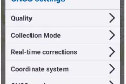
At the same time, Supergeo has improved the mechanism of the online editing, enabling users to edit data even when there is no internet connection. The edited data will be synchronized when the internet is available. Other than WMS, WMTS, and WFS, SuperPad 10 supports a new OGC standard- WFS-T, which is an editable online map service. Users of SuperPad 10 can edit map features published by any GIS servers as they are in WFS-T format. Lastly, several measurements for GPS signal quality and satellite configuration are added to SuperPad’s GPS alert, including HDOP, VDOP, PDOP, Acc, and EPE. If the signal quality reaches the designated threshold, SuperPad will warn the user by a beep. Therefore, fieldworkers only have to wait for the sound instead of to check GPS signal box all the time.
In short, this new version of SuperPad not only upgrades the overall performance but also includes many practical new features, helping users to greatly enhance the efficiency of fieldworks. Also, the new interface design and layout will definitely provide a smoother user experience, especially on tablet computers.
Watch the new features in SuperPad 10:
https://www.youtube.com/playlist?list=PLPR8SoCq6qHTB6l9l12W8m2ssI5pa7Rln
Get the free trial of SuperPad10 Beta:
http://www.supergeotek.com/download_6_mobile.aspx