
The traditional way of geological mapping is to record the location of rock outcrops, rock and fossil samples and structures observed in the field. The detailed description and sketches of rock outcrops, field observations and measurements are recorded in geological field notebooks. While satellites cannot entirely replace the expert in the field, they can certainly help – as a recent effort in Africa shows.
ESA has recently supported a pan-African initiative to collect, interpret and disseminate satellite information on geology and mineral resources such as metallic ores.
This ESA-funded effort has paved the way for the German geo-information company GAF to help the African Mineral Geoscience Initiative. The aim of initiative, which is led by the African Union Commission and supported by the World Bank Group, is to catalogue Africa’s geology and mineral resources.
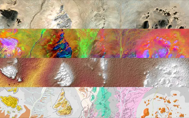
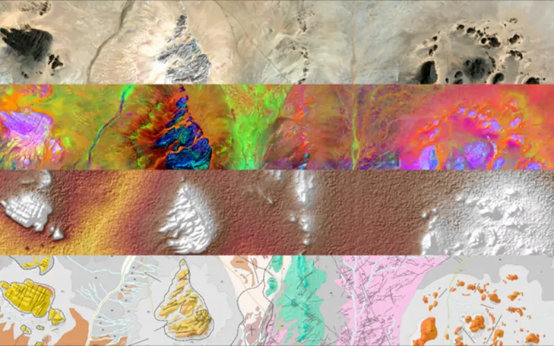
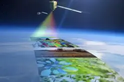
Examples of layers used for mapping.
Credit: ESA
This task is made somewhat easier thanks to freely available data from the Copernicus Sentinel-1 and Sentinel-2 missions, as well as information from other satellites such as NASA’s Shuttle Radar Topography Mission and the US WorldView-3.
The idea is to produce geological maps for various climatic zones and different types of geology, especially in areas where data are scarce, not sufficiently detailed or outdated.
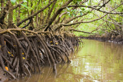
Initial results show that while arid and semi-arid areas can be mapped accurately, tropical areas are more of a challenge.
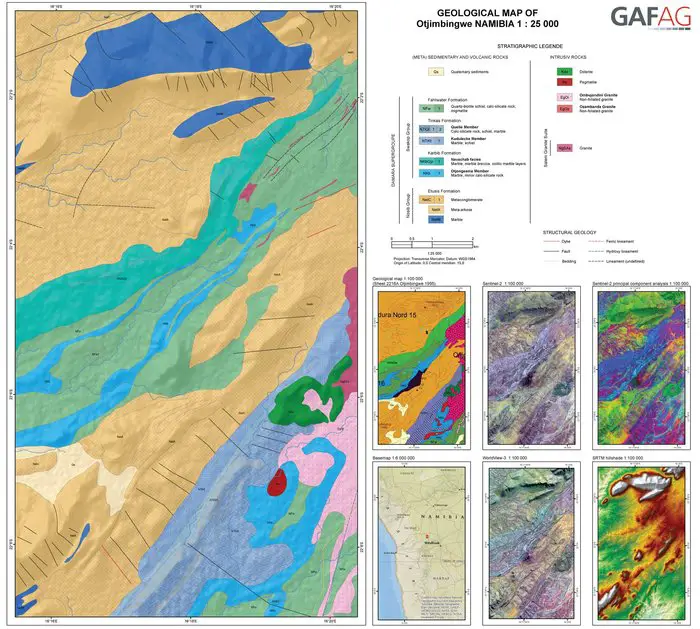
Geological mapping.
Credit: ESA
This is because these regions are typically covered with vegetation, which optical sensors cannot see through to gain information on the ground beneath. In these regions, radar and ground elevation data have been used, so structural information such as river networks form the basis of the maps.
Overall, however, the initiative has shown how large areas can be mapped consistently and efficiently, which is of particular interest for surveying regional geology and for mining minerals.
Francisco Igualada, senior mining specialist at the World Bank said, “Earth observation is one of the major sources of information for new and improved geological mapping.
Source: ESA


Is there additional data for this project ?