The Masdar Institute of Science and Technology (MI) has announced that it has launched an environmental regional observatory (http://earth.masdar.ac.ae/), offering comprehensive information for monitoring coastal processes in the UAE and the region.
Masdar Institute of Science and Technology is the world’s first graduate-level university dedicated to providing real-world solutions to issues of sustainability. The Institute’s goal is to become a world-class research-driven graduate-level university, focusing on advanced energy and sustainable technologies.
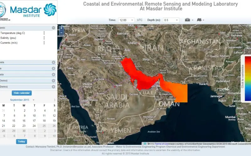
Developed by a team led by Dr. Marouane Temimi, Associate Professor, Water and Environmental Engineering program, the environmental data portal offers valuable information on the state of the Arabian Gulf including sea currents, temperature, salinity, and other seawater quality parameters related to oil spills and red tides that are useful for several applications. Among other team members, Master’s student Sheikha Al Kitbi, who graduated early this year, worked on the satellite-based detection of red tides in the Arabian Gulf. She co-authored a scientific publication that is under review.
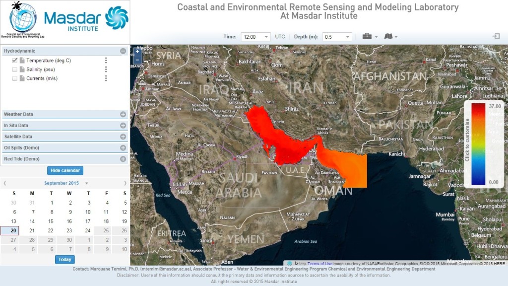
Coastal and Environmental Remote Sensing and Modeling Laboratory At Masdar Institute
Dr. Behjat Al Yousuf, Interim Provost, Masdar Institute, said,
“Being able to accurately monitor the environment of the UAE and wider region is necessary for effective natural resource management and preservation. The information this tool provides will allow tracking of environmental changes in the region in real-time. Through innovative tools like this portal, Masdar Institute supports the UAE’s goals for environmental sustainability and resource management.”
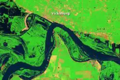
Users of the website can obtain in-depth information including forecasts for the Arabian Gulf for the next five days with hourly updates. The portal is publicly accessible but registered users will have access to advanced functionalities. In addition, the portal includes some of the most recent satellite images of the region, and can provide information on oil spills, red tide events, weather conditions from remote sensing images, ‘in situ’ observations, or advanced numerical models. This will be immensely helpful to several stakeholders in the government and private sector, who require such information on a regular basis.
Dr. Temimi said,
“The environmental data portal provides information on oil spills, red tides, sea circulation, salinity, and temperature. We have included an example of an oil spill to showcase our capability to track and predict the trajectories of not only coastal hazards like oil spills and red tides but also dust storms and flooding, using satellite imagery and modeling. We believe this data portal is set to become the first destination of several end-users like government agencies, desalination plant operators, oil companies, ports, and others who are interested in monitoring environmental processes in the UAE and the region.”
The use of remote sensing and models along with in situ observations provides users with a comprehensive overview of the state of the Arabian Gulf and on potential hazards that could threaten coastal infrastructure. Dr. Jun Zhao, a research scientist and remote sensing expert, said “the role of remote sensing is crucial in the region as it gives us, with frequent refresh, a synoptic view of the conditions in the Arabian Gulf and complements information derived from models”.