Punjab to use Remote Sensing and SMS Technology to Battle Against Crop Residue Burning
According to recent news reported by the Times of India, Punjab is set to make its battle against crop residue burning real time, with the state authorities using geospatial data to detect crop fires and alert the concerned deputy commissioner and district monitoring committees through SMSs.
This plan is the outcome of the December 10, 2015, orders of the National Green Tribunal (NGT), asking the state to use remote sensing facilities to monitor and curb crop burning. The state authorities had started using the services of the Punjab Remote Sensing Centre, (PRSC), Ludhiana, last year, but it is for the first time that SMSs would be sent to DCs and monitoring committees.
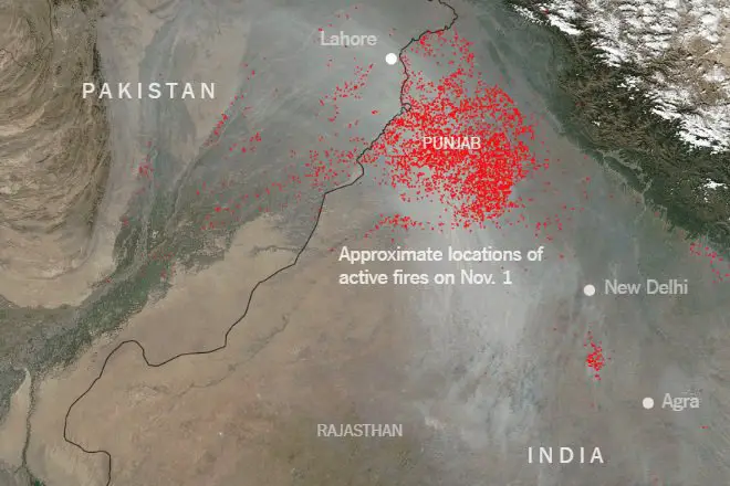
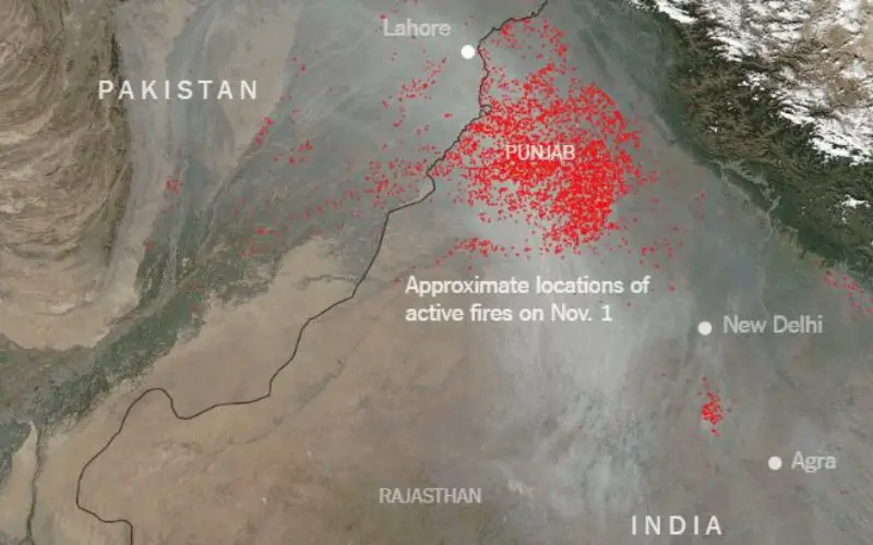
Farmers in neighboring Punjab and Haryana have been setting fire to paddy stubble in their fields.
Credit: Financial Express
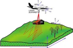
The PRSC would be using Remote Sensing (RS), Geographic Information System (GIS) and Global Positioning System (GPS) to collect geospatial data which would be used to take immediate action against errant farmers. Prodded by the National Green Tribunal to use remote sensing facilities to check stubble burning, the authorities in Punjab plan to take the SMS route to control air pollution. For the first time, authorities will send SMSs to deputy commissioner concerned and district monitoring committees.
Manpreet Singh, chairman of the Punjab Pollution Control Board (PPCB), said ,”We have already deposited Rs 7 lakh with the PRSC as expenses toward SMSs that are to be sent to the concerned authorities.” He said, “The NGT had made the district authorities responsible for taking action against violators, while the PPCB would be collecting a report from all district heads and compiling the data on the SMSs sent and action taken against violators. This data would be put before the Central Pollution Control Board.