Presagis Introduces New Automated Virtual Environment Production Solution
November 27 2017 – Montreal, Canada – Presagis™, a recognized leader in modeling and simulation software, today introduced VELOCITY, a next-generation software solution that automates the production of large synthetic training environments.
By adopting and integrating the best of breed tools from the 3D visual effects, gaming, Geographic Information Systems (GIS) and architectural design fields, VELOCITY is able to analyze and transform massive amounts of geospatial data to produce large, realistic and immersive 3D virtual environments for a wide array of simulation and gaming platforms.
Presagis’ VELOCITY design and development is in direct response to the challenges facing government agencies and non-governmental organizations as they attempt to manage overwhelming amounts of geospatial data.
“The sheer volume of available data is exploding,” explains Jean-Michel Brière, Presagis’ President. “In trying to navigate this data-rich environment, clients face a stark choice; either ignore precious data updates, or rethink and streamline processes.”
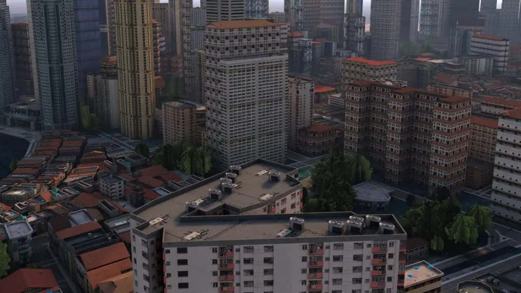
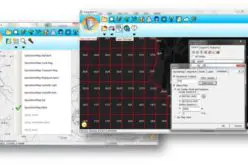
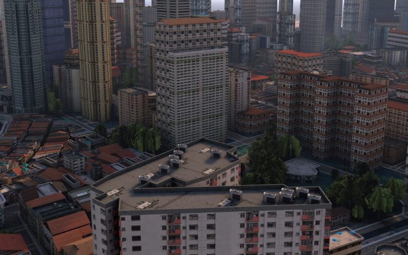
Example of virtual environment generated with VELOCITY.
Credit: Presagis
From the “ground truth” geo-specific databases needed for mission critical operations, to the procedurally generated geo-typical training terrains that save time and money, VELOCITY lets clients seamlessly transform diverse sources of geospatial data into immersive synthetic environments.
“Never have such rich, accurate virtual environments been created so quickly and inexpensively. Whether it is a synthetic environment to be visible by UAV sensors from 60,000 feet, 30,000 feet in an aircraft, from a helicopter at 2,000 feet, or from a human at ground level, the accuracy and representation must be realistic, reliable and shareable,” said Stéphane Blondin, Presagis’ Vice President of Product Management and Marketing. “Presagis is very aware of the market’s direction and the need for cutting-edge, game-like graphics. VELOCITY synthetic environments can be exported to many other traditional and non-traditional formats – including game engines, such as Unreal® UE4 and Unity® software.”
Presagis’ VELOCITY is scalable to grow with a production pipeline and manage larger and larger volumes of data all the while keeping focus on speed by only processing new data instead of reprocessing all the data all the time.
“The result is a cost-effective terrain generation solution that produces easily shareable environments that are immersive and accurate,” adds Brière. “VELOCITY is more than data transformation. Once we add crowds, traffic, pattern of life, weather, and interactions and behaviors, we are creating the complexity of the real world in a virtual one.”
Presagis will be demonstrating VELOCITY at the upcoming Interservice/Industry Training, Simulation and Education Conference (I/ITSEC) taking place November 27 to December 1 in Orlando, FL. (Presagis booth: #1762).
About Presagis
Presagis is a global leader providing commercial modeling, simulation and embedded software solutions to the aerospace, defense and security, and critical infrastructure markets. Presagis combines an open simulation development framework with expert professional services to help customers streamline development workflows, reduce project risks, and deliver game-quality immersive simulations. Presagis is also at the forefront of avionics software design for certifiable cockpit displays. The company serves hundreds of customers worldwide, including many of the world’s most respected organizations such as Boeing, Lockheed Martin, Airbus, BAE Systems, and CAE. For more information, visit www.presagis.com.
For further information: Stéphane Blondin, Vice President of Product Management and Marketing, Tel: +1 514 434-3874, E-Mail: Stephane.Blondin@presagis.com