Portland State Laser Mapping Project Shows Global Warming Effects in Antarctica
(Portland, Ore.) Aug. 9, 2017 – Portland State University researchers and the National Science Foundation (NSF) have publically released high-resolution maps of the McMurdo Dry Valleys, a globally unique Antarctic polar desert.
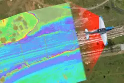
The PSU scientists led a team of researchers supported by the NSF to map the area using LIDAR technology. LIDAR, which stands for Light Detection and Ranging, is a remote sensing method that uses pulsed laser beams to measure the Earth’s surface and make precision elevation maps.
The maps cover 3,564 square kilometers of the McMurdo Dry Valleys and allow researchers to compare the present-day conditions with aerial surveys conducted almost 13 years ago.
The data, collected by aerial survey missions flown in the Southern Hemisphere summer of 2014-2015, provides detailed imagery of the perpetually ice-free region, where changes, such as rapid erosion along some streams, have been observed in recent years.
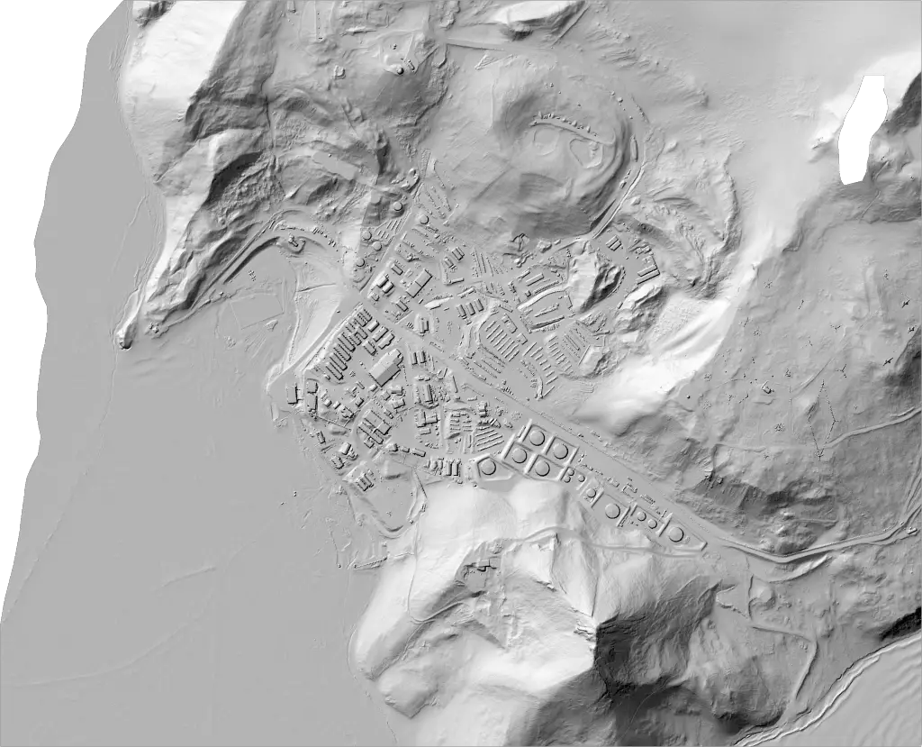
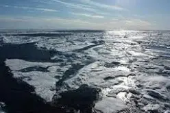
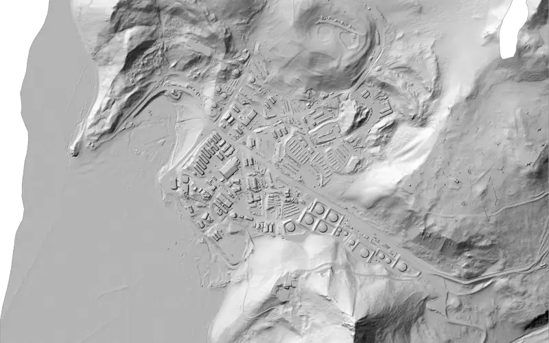
Lidar-derived digital surface model (DSM) hillshade of McMurdo sound and station from the 2014-2015 NSF lidar dataset.
“The project will help us assess what parts of the landscape are vulnerable to climate warming,” said lead researcher and PSU geologist Andrew Fountain. “We’ve seen dramatic changes in the topography due to subsurface ice melt. Overall the glaciers have thinned by several feet. These are examples of what will happen if the region warms in the future as the models predict,” he said.
The Portland State team and the National Center for Airborne Laser Mapping carried out the mapping aboard a Twin Otter aircraft during an eight-week field season, beginning in December of 2015.
The McMurdo Dry Valleys are interesting to a wide range of scientists from biologists to geologists to glaciologists. The valleys are, for example, one of the few places on the massive continent — which is the size of the U.S. and Mexico combined — where bedrock is exposed, allowing geologists to reconstruct the continent’s geological history.
The region also is home to one of NSF’s Long Term Ecological Research sites, which support studies of its unusual habitat, dominated by microbial life, both in the soil and in unique ecosystems under at least one of its glaciers and in several of its highly salty lakes.
The area also is one of the few regions on Earth that most closely resembles the surface of Mars. NASA has conducted studies there to look at how microbial life survives in such a harsh environment, giving them insight on what they may find on Mars.
Evidence of past glacial advance and retreat is also more easily observed in the Dry Valleys, which provides window into the past behavior of the vast Antarctic ice sheets, the activity of which can influence global sea levels.
The LIDAR maps are publicly available on two NSF-funded facilities: Open Topography , and the Polar Geospatial Center.
About Portland State University (PSU)
As Oregon’s only urban public research university, Portland State offers tremendous opportunity to 27,000 students from all backgrounds. Our mission to “Let Knowledge Serve the City” reflects our dedication to finding creative, sustainable solutions to local and global problems. Our location in the heart of Portland, one of America’s most dynamic cities, gives our students unmatched access to career connections and an internationally acclaimed culture scene. “U.S. News & World Report” ranks us among the nation’s top 10 most innovative universities. http://www.
Media Contact
Andrew Fountain
andrew@pdx.edu
503-725-3386
Source: PORTLAND STATE UNIVERSITY/EurekAlert