Pennsylvania Launches New GIS Application and Tutorial to Help Users Find Oil & Gas Well Mapping Information
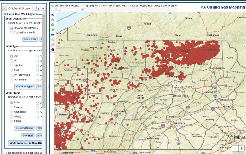
Harrisburg, PA – The Department of Environmental Protection (DEP) today released an updated version of a GIS application that allows users to learn information and download reports about oil and gas wells in Pennsylvania. DEP also released a new video tutorial that explains how to use the PA Oil and Gas Well Mapping application and what information is available to retrieve. The video is available on DEP’s YouTube Channel.
“This updated Oil and Gas Well Mapping application puts information about both conventional and unconventional oil and gas wells at your fingertips,” DEP Acting Secretary Patrick McDonnell said. “Making such data available and easy to use promotes transparency and allows the public to generate the information they want on demand.”
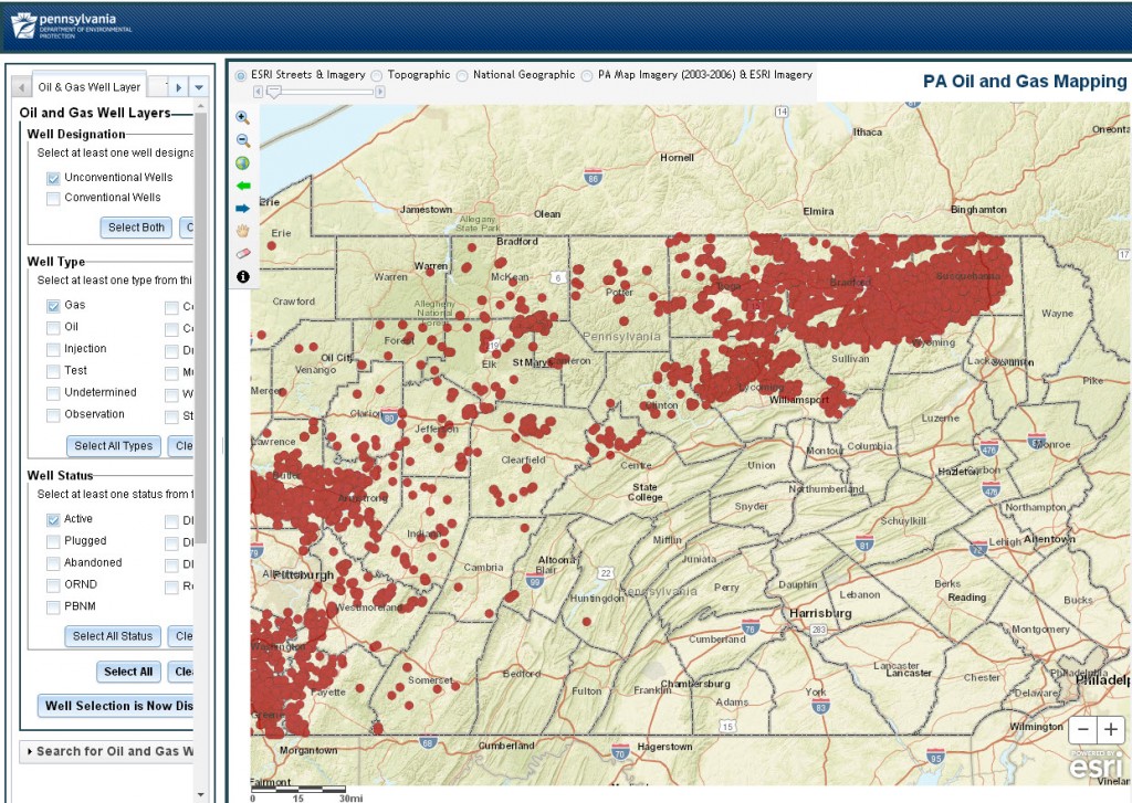
Users can locate wells by searching based on the permit number, or specific address, county, latitude and longitude, municipality or zip code. In addition to being able to view the location of oil and gas wells, users can also access specific information about each well, including inspection, violation, and enforcement information as well as production data. Additionally, users can access and view a number of documents associated with those wells, including well permit applications, well permits, inspection reports, operator responses to violations, and well site emergency response plans. DEP plans to make additional information available as we transition to collecting more oil and gas well data in an electronic format.
Users can also pinpoint a particular point on the map and draw a proximity buffer around it to learn what other features are located within that buffer zone such as coal mining operations, landfills and waste facilities.
“This application is also beneficial to county and emergency responders who can quickly access unconventional well site emergency response plans in the case of emergencies,” Acting Secretary McDonnell said.
The PA Oil and Gas Well Mapping application is available on DEP’s website.