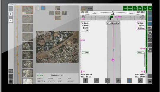
Most Common Business Uses of Photogrammetry: Contributed by – Photogrammetry is the use of photography in surveying and mapping. It’s used to measure distances between objects, and photogrammetry software can utilize images to create 3D renderings. … read more →
Free Highway Exits & Interchanges Data for Use with Maptitude 2018
Newton, Massachusetts (USA) – Caliper is excited to announce the release of new highway exit data for the United States and Canada. Users of Maptitude 2018 with the Canada or United States … read more →
PCI Geomatics Releases Geomatica and GXL 2018
MARKHAM, Ontario, Canada, October 1, 2018 — PCI Geomatics announced today the release of Geomatica 2018, the company’s flagship software for complete and integrated desktop and enterprise geoimage processing. Geomatica … read more →
Most Common Business Uses of Photogrammetry
Contributed by – Photogrammetry is the use of photography in surveying and mapping. It’s used to measure distances between objects, and photogrammetry software can utilize images to create 3D renderings. … read more →
Free U.S. Traffic Count Data for Use with Maptitude 2018 Mapping Software
Newton, Massachusetts (USA) – Caliper is excited to announce the release of free USA traffic count data for Maptitude 2018 users. This latest map layer includes fields with total Annual Average Daily Traffic … read more →
New BlueSky GNSS Firewall From Microsemi Provides Secure, Continuous Timing Integrity in GPS-Denied Environments
Showcasing at ION GNSS+ in Booth 612, Security-Hardened System Provides Resilience for Over 30 Days Without Live Sky Access ALISO VIEJO, Calif., Sept. 24, 2018 /PRNewswire/ — GPS revolutionized the world with … read more →
USGIF Releases Report on Geospatial Intelligence & Community Resilience
Learn how and why local, state, and federal governments should employ geospatial intelligence to prepare for increasing threats posed by natural disasters Herndon, Virginia (September 24, 2018)—The United States Geospatial … read more →
GIS Resources Magazine (Issue 3 | September 2018): Geospatial Technologies to Preserve and Conserve Forests
GIS Resources Magazine (Issue 3 | September 2018): Geospatial Technologies to Preserve and Conserve Forests September 24, 2018 – GIS Resources, a leading global platform for latest and high-quality information source of the … read more →
RMSI Appoints Robert G. Brook as Vice President, Utility
New Delhi, September, 21, 2018: RMSI, a leading geospatial solutions provider announced the expansion of its utility leadership team with the appointment of Robert G. Brook as Vice President, Utility. … read more →
Pix4D Accelerates Growth with A New Office in Madrid
A centre of innovation in the heart of Spain Lausanne, Switzerland: On November 1st 2018, Pix4D opens a new R&D office in Madrid. It is the company’s fifth office after … read more →
USGIF to Host Series of Unique Geospatial Intelligence Events in St. Louis
October’s Tech Showcase West to feature unclassified and classified agendas in addition to opportunities for young professionals and students Herndon, Virginia (September 13, 2018)—The United States Geospatial Intelligence Foundation (USGIF) … read more →