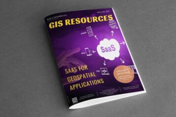
Most Common Business Uses of Photogrammetry: Contributed by – Photogrammetry is the use of photography in surveying and mapping. It’s used to measure distances between objects, and photogrammetry software can utilize images to create 3D renderings. … read more →
AllSource Analysis Wins NGA Contract to Identify and Monitor North Korean Military Facilities
LONGMONT, Colorado, September 12, 2019 — AllSource Analysis Inc. (AllSource), a leader in complete geospatial intelligence, has been awarded a $1.956 million contract by the National Geospatial-Intelligence Agency (NGA). The … read more →
Virtual Surveyor to Unveil Enhanced Cut-and-Fill Mapping in Drone Surveying Package at InterGEO 2019
Faster, More Accurate Volume Calculations LEUVEN, Belgium, 10 September 2019 – Virtual Surveyor has added cut-and-fill mapping capabilities to Version 7.0 of its popular drone surveying package. The new functionality … read more →
Select and Download Sections of Large Point Clouds Right in Your Browser with NavVis IndoorViewer 2.5
The upcoming release of NavVis IndoorViewer 3D building visualization software will include a new feature to select, crop and download point cloud sections in browser. The beta version of the … read more →
RMSI Appoints Hugo van der Linde as Managing Director, RMSI UK & Europe
New Delhi, August 20, 2019: RMSI, a leading geospatial and engineering solutions provider announced the expansion of its leadership team with the appointment of Hugo van der Linde as Managing … read more →
Pan India Drought : A Near Reality – An Analytical Story
Contributed By: This analytical story is about Drought, its frequency and intensity across India. This story emerged while working on Drought Vulnerability Management System. This story is due to effort put … read more →
TatukGIS Hosted OpenStreetMap Tile Server
TatukGIS hosted OSM (world map) web tile servers are available as a free service for use with TatukGIS software, including custom GIS applications developed by customers using the TatukGIS Developer … read more →
RIEGL Continues on Course for Success: RIEGL Invests in New Office and Production Facilities!
New, additional facility expansions at the headquarters in Austria as well as a new facility in the United States. RIEGL, an internationally successful manufacturer of LiDAR scanners for surveying applications … read more →
4th GEOINT & Open Source Analytics Summit
Defense Strategies Institute will host the 4th GEOINT & Open Source Analytics Summit this September 10th & 11th in Washington, DC. The 2019 Summit will address the challenges of integrating … read more →
ISRO’s PSLV-C46 Successfully Launches RISAT-2B Radar Imaging Satellite
May 22, 2019 – ISRO – India’s Polar Satellite Launch Vehicle (PSLV-C46) has successfully launched RISAT-2B satellite from Satish Dhawan Space Centre(SDSC) SHAR, Sriharikota. RISAT-2B is a radar imaging earth observation … read more →
360-degree Camera Provides Ground-based Imaging Following Weather Disasters
iSTAR Pulsar used by Site Tour 360 to document damage after hurricane and tornado Edinburgh, UK & Gainesville, FL – May 16, 2019 – NCTech, a developer of reality imaging … read more →