OpenTopography Releases Raster Datasets for California, Colorado, New Hampshire and Washington
Recently OpenTopography has to announce the release of seven new raster datasets. These datasets are available for areas in California, Colorado, New Hampshire and Washington. All datasets were collected between 2010 and 2012.
These datasets are derived from previously released point cloud data, and allow users to quickly and easily access high-resolution digital elevation models.
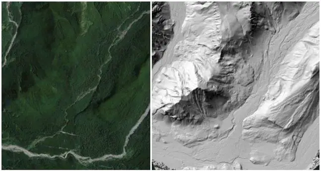
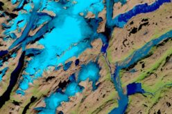
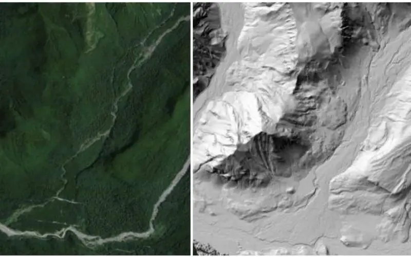
(left) Google Earth image showing forested area of Mount Rainier. (right) Bare earth hill shade model highlighting lateral moraines, river terraces, and a braided river in the same location.
Credit: OpenTopography
Six of these datasets were collected by the National Center for Airborne Laser Mapping (NCALM). NCALM is a NSF-funded center that supports the use of airborne laser mapping technology (a.k.a. lidar) in the scientific community and is jointly operated by the Department of Civil & Environmental Engineering, Cullen College of Engineering, University of Houston and the Department of Earth and Planetary Science, University of California, Berkeley. The release of these data via OpenTopography is the product of a memorandum of understanding (MOU) between OpenTopography and NCALM to make OT the primary distribution pathway for NCALM data.
The seventh dataset comes from the U.S. Geological Survey and covers the Salton Sea area of southern California.
- University of Colorado, Boulder: May 2010
- Raleigh Peak, Colorado: May 2010
- West Swanzey, NH: Geomorphic Response to Dam Removal, Ashuelot River
- Yosemite National Park: Poopenaut Valley and Wawona
- Southwest Flank of Mt.Rainier, WA
- Hyak, WA: Cedar River Municipal Watershed Snow Modeling
- 2010 Salton Sea Lidar Collection
OpenTopography facilitates community access to high-resolution, Earth science-oriented, topography data, and related tools and resources. The OpenTopography Facility is based at the San Diego Supercomputer Center at the University of California, San Diego and is operated in collaboration with colleagues in the School of Earth and Space Exploration at Arizona State University and at UNAVCO.