OGA Makes Another Set of Data Packages Openly Available for Oil and Gas Explorers
The Oil and Gas Authority (OGA) is continuing to make more and more data openly available in an effort to help revitalise exploration of oil and gas in the UK Continental Shelf (UKCS).
The latest significant data release follows the publication of a suite of subsurface data packages in June related to undeveloped discoveries.
The OGA has committed to making all these data openly and transparently available to help widen understanding of the basin’s subsurface and to build interest in advance of the 30th Offshore Licensing Round opening. This round will focus on the more mature areas of the UKCS – some of which were last offered for licensing more than 40 years ago – and is expected to be the most significant offshore round in recent decades.
The latest data releases include:
- UKCS-wide multi-satellite gravity data (from Getech)
- Approximately 1,000 wells with joined digital well logs (from both CGG and OGA sources)
- Core analysis, formation pressure and geothermal databases (from CGG)
- A report on the Upper Jurassic Sequence Stratigraphy and Sandstone Play Fairways of the Late Jurassic Humber Group of the UK Central Graben (from Geostrat)
- The first of a set of regional geological maps from the OGA’s regional geological mapping project, (carried out by Lloyd’s Register) covering the Central North Sea and Moray Firth areas
- A number of formerly proprietary reports, courtesy of Shell and ExxonMobil, covering regional and subsurface aspects of the Central North Sea, including individual operators’ experiences in low cost well and completion design
Gunther Newcombe, OGA’s Operations Director, said: “We want to help make the UK as attractive as possible to explore for oil and gas. Part of this is about making as much data as possible openly available so people can understand more about our subsurface and make well-informed decisions in advance of the 30th Offshore Licensing Round opening later.
“The delivery of the first set of regional geological maps is a key milestone in what is a three-year project to deliver a consistent set of geological maps for the whole of the UKCS.”
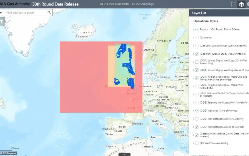
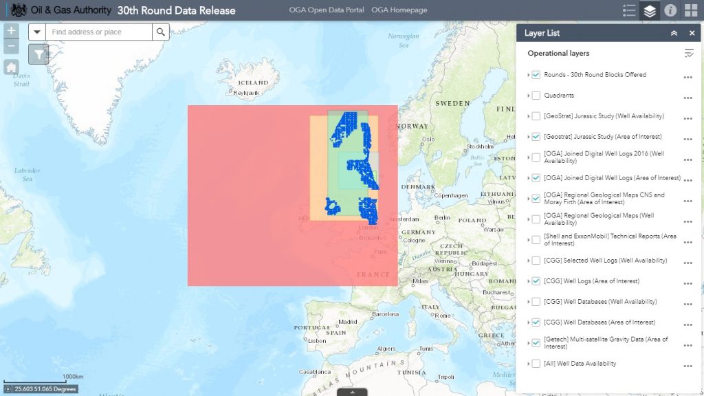
All of the openly available data packages can be accessed through the online maps on the OGA website which include an area of interest outline for each of the products. In addition, the OGA has made a summary of the products available for each package, including additional work carried out to enhance the data delivery. The data can also be accessed via the OGA’s Open Data site.
Source – OGA’s website