Griffith University research has led to a comprehensive and interactive guide to a major policy instrument tackling global warming
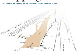
Researchers from Queensland’s Griffith University have helped create a comprehensive and interactive map of the United Nations Framework Convention on Climate Change (UNFCCC).
A unique tool for policy makers and anyone concerned with climate change generally, the map is timely given the beginning of the United Nations Conference on Climate Change in Paris, and has applications across fields including science, economics, government and industry.

This is Dr Tim Cadman, of Griffith University’s Institute for Ethics, Governance and Law.
CREDIT: Griffith University
Lead researcher Dr Tim Cadman, from Griffith University’s Institute for Ethics, Governance and Law (IEGL), says the map — designed by Dutch IT company LUST — will increase understanding of the UNFCCC as a policy instrument for combatting climate change.
Dr Cadman has spent the past year identifying and mapping the institutions, agencies and organisations involved in the UN’s climate regime.
“One of the biggest problems confronting climate negotiators and the public is the complexity of the UN Convention,” says Dr Cadman.
“With more than 300 different institutions, government agencies and international organisations involved, there is a real danger that ‘silos’ will be created, so nobody knows what anybody else is doing.
“This will lead to a poor outcome in Paris. Our tool aims to break down those barriers.”
The map is part of a major project — Towards Global Carbon Integrity: Applying integrity systems methodology to the Global Carbon Crisis — funded by the Australian Research Council and led by IEGL Director, Professor Charles Sampford.
“This exciting project builds on our work on mapping and assessing national integrity systems going back to the late 1990s,” says Professor Sampford.
“There are many integrity challenges in meeting global carbon emissions targets, and addressing those challenges requires a mixture of laws, norms and institutions.
“This project seeks to understand that mixture and the map charts the way they interact.”
According to LUST Director Mr Jeroen Barendse, from a design perspective the project seeks to move beyond a two-dimensional mapping exercise by encompassing visually engaging graphics, connected databases of information, surveys and other interactive components.
“The project is designed to engage governmental Parties to the Convention as well as civil society and non-governmental stakeholders in a process of critical reflection on the design of the current regime, and how to improve it into the future,” he says.
The interactive map can be explored at http://climateregimemap.
It is optimised for Google Chrome as a browser and is best viewed on an iMac desktop computer, but will work on other systems.