A new digital map of every publicly accessible greenspace in Scotland will be released in March 2017.
Recently the Ordnance Survey (OS) and the Scottish Government released an update on the project which will ultimately make it easier for people to find and access every green corner of our neighbourhoods, towns and cities.
Building on the 2011 Scottish Greenspace Map, the new OS dataset will provide a comprehensive view of location, extent and type of recreational spaces across Scotland.
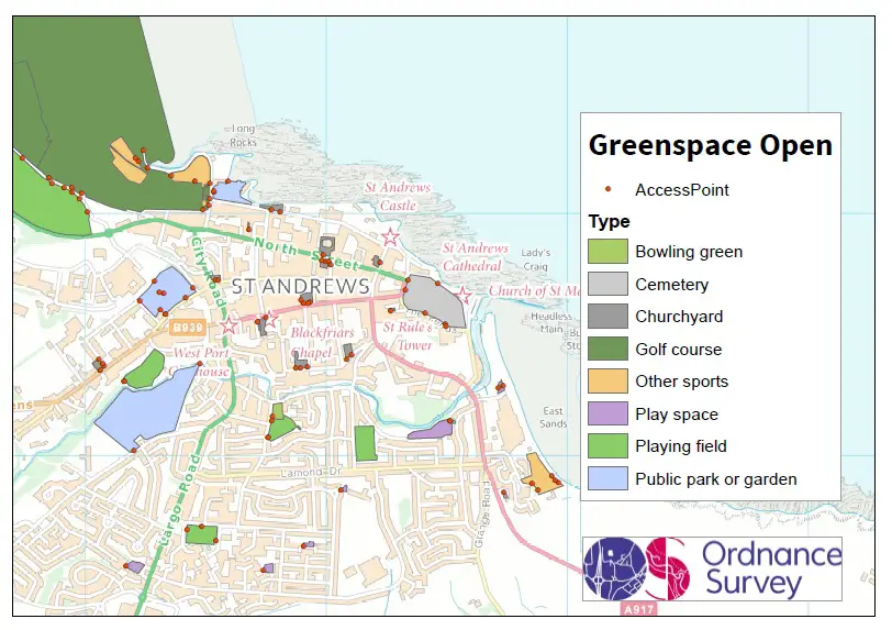
Greenspace Open extract of St Andrews. Credit: OS
John Kimmance, OS Director for Public Sector, said: “This is an exciting project, which we are pleased to be working on with the Scotland Greenspace Project Board. OS data contains a vast range of geographic features from which we are identifying the boundaries and classifying all of the publicly accessible greenspaces in Scotland.”
The project will deliver two detailed datasets, both an open data and premium version. The open data version will be available to download and will also be accessible to view via the popular OS Maps app from Ordnance Survey. The premium version will provide more detailed information to support work by public sector partners and academics on greenspace planning, management, policy and research.
John added: “We are pleased that this dataset will be available as open data and via the OS Maps app from March 2017. The addition of the new greenspace data within OS Maps will enable users to quickly and easily identify, access and enjoy new areas of the great outdoors.”
Kevin Stewart, Minister for Local Government and Housing said: “In this the Year of Innovation, Architecture and Design, it is exciting to see Scotland’s Greenspace Map making new strides forward. These free, up-to-date, comprehensive maps of accessible greenspace allow us to see where to go and enjoy nature. Through this new innovative platform – a world-first when it was first launched in 2011 – it will be easier for people to enjoy our wonderful outdoors.
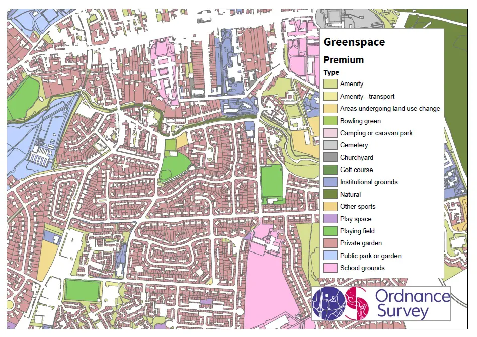
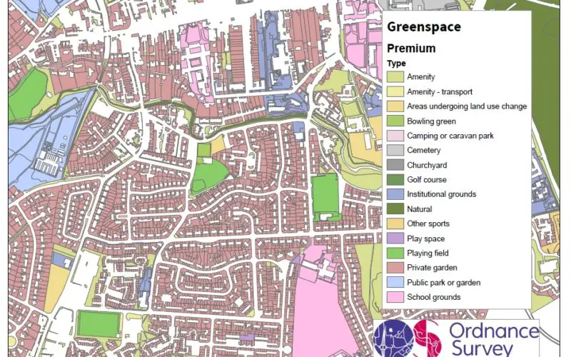
Greenspace Premium extract of St Andrews. Credit: OS
“Evidence shows that improving access to local greenspace benefits physical health, mental well-being and provides social opportunities. That’s why earlier this year we added it as a new national indicator, to enable us to track progress. The Greenspace Map helps identify where there is a lack of greenspace or of particular types of open space so that local authorities, public sector partners and community groups can develop plans to address this and take action to improve access within local neighbourhoods.”
The new Scotland Greenspace Map is being developed in partnership with the Scottish Government, greenspace scotland, Ordnance Survey and other public sector organisations as a collaborative project under the One Scotland Mapping Agreement (OSMA). The dataset will be published in March 2017 and updated annually.
The announcement was made in Edinburgh at a conference discussing the new National Performance Framework indicator ‘improving access to local greenspace’ and delegates were able to view sample data from the new map.