Kathmandu – According to recent news by The Himalayan Times, the Department of Soil Conservation and Watershed Management, Nepal has started a pilot project of landslide hazard mapping from Dolakha district, one of the most badly affected districts by last year’s earthquakes.
According to the analysis of the National Society for Earthquake Technology-Nepal, a total of 3,220 landslides have been recorded between 1971 and 2013, averaging about 76 landslides per year.
The process for mapping landslide hazards has begun in Sundrawati VDC of Dolakha, where a number of landslides have been recorded after the devastating earthquakes. This project is mostly also an attempt to find whether landslide hazard mapping is effective. All landslide-related research work would be included in a landslide inventory along with the data collected from the hazard mapping.
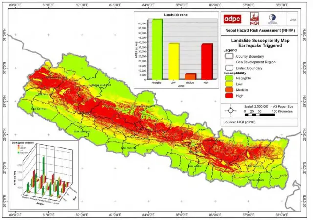
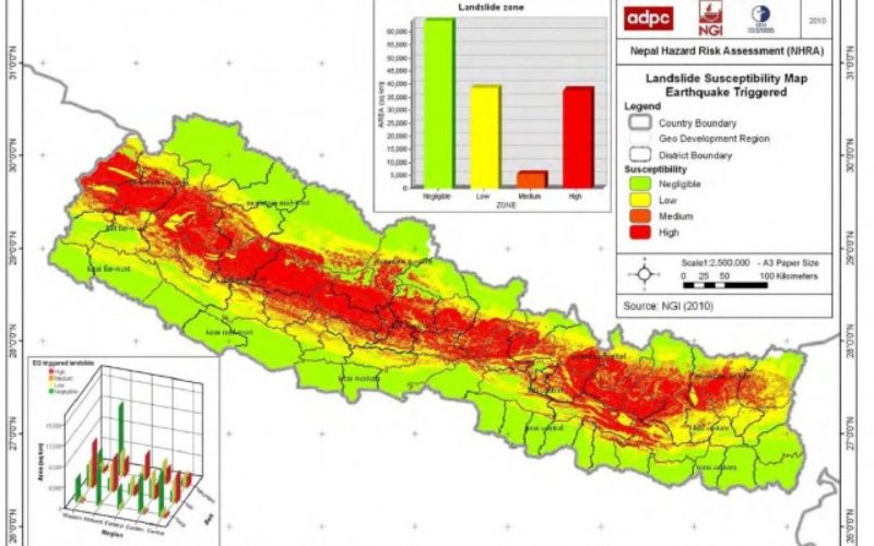
The Nepal Hazard Risk Assessment Project map of seismically-induced landslide susceptibility
Image Source: http://www.gfdrr.org
After last April’s devastating earthquake in Nepal, many geologists have warned of increased vulnerability to landslides and demanded immediate landslide hazard mapping throughout the country to produce landslide-related data.
With the pilot project beginning, the department has come up with the plan of establishing a National Landslides Management Centre at the department in Babarmahal, Kathmandu.
The department is consulting related stakeholders to establish a centre at the earliest to gather information related to landslides in Nepal.
There is no integrated, authentic government data on landslides in Nepal, apart from researches, programmes, and time-bound studies conducted by I/NGOs.