Modeling Glacier Elevation Change from DEM Time Series
– Wang, D.; Käb, A. Modeling Glacier Elevation Change from DEM Time Series. Remote Sens. 2015, 7, 10117-10142.
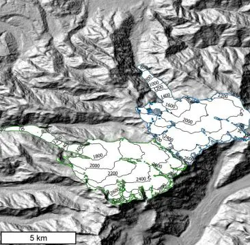
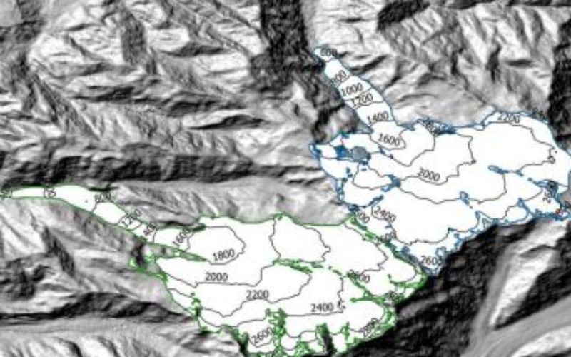
Shaded relief showing Fox Glacier and Franz Josef Glacier located in the
Southern Alps, New Zealand. Glacier extents are from the Randolph Glacier Inventory
Abstract: In this study, a methodology for glacier elevation reconstruction from Digital Elevation Model (DEM) time series (tDEM) is described for modeling the evolution of glacier elevation and estimating related volume change, with focus on medium-resolution and noisy satellite DEMs. The method is robust with respect to outliers in individual DEM products. Fox Glacier and Franz Josef Glacier in New Zealand are used as test cases based on 31 Advanced Spaceborne Thermal Emission and Reflection Radiometer (ASTER) DEMs and the Shuttle Radar Topography Mission (SRTM) DEM. We obtained a mean surface elevation lowering rate of −0.51 ± 0.02 m·a−1 and −0.09 ± 0.02 m·a−1 between 2000 and 2014 for Fox and Franz Josef Glacier, respectively. The specific volume difference between 2000 and 2014 was estimated as −0.77 ± 0.13 m·a−1 and −0.33 ± 0.06 m·a−1 by our tDEM method. The comparably moderate thinning rates are mainly due to volume gains after 2013 that compensate larger thinning rates earlier in the series. Terminus thickening prevailed between 2002 and 2007.
Keywords: DEM time series; ASTER; elevation change; Fox Glacier; Franz Josef Glacier