GeoSLAM and Bentley Systems Join Forces to Take Mobile Reality Modelling Indoors
ZEB-REVO Image – Credit GeoSLAM
BENTLEY YII 2017, SINGAPORE, OCTOBER 5, 2017 – GeoSLAM – the experts in “go anywhere” 3D mobile mapping technology, and Bentley Systems, a leading global provider of comprehensive software solutions for advancing infrastructure, today announced a partnership to enable the simple and fast production of hybrid reality models in any environment.
Mark Reid, VP of Product Management, GeoSLAM said, “GeoSLAM has already disrupted the reality capture industry by changing the economics of 3D laser scanning enabling buildings, infrastructure, and other challenging environments to be mapped at unprecedented speeds. The simplicity of the ZEB-REVOhandheld mobile mapping system has also truly democratized laser scanning enabling anybody to document their facility, or construction site without being a survey expert. The next stage for us is to further improve how our results can be both interpreted and consumed within typical engineering and GIS workflows – and our partnership with Bentley is the perfect vehicle for this.”
Bentley Systems’ reality modelling software, ContextCapture, available on desktop and mobile devices, produces engineering grade textured 3D models for design, construction, and operations derived purely from photographs. A quick and inexpensive way to provide real world context, the software is commonly used for modelling outdoor environments either from images taken from the ground or with the use of drones.
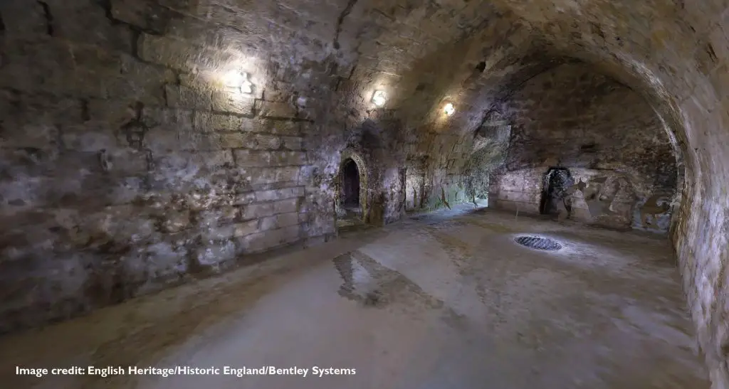
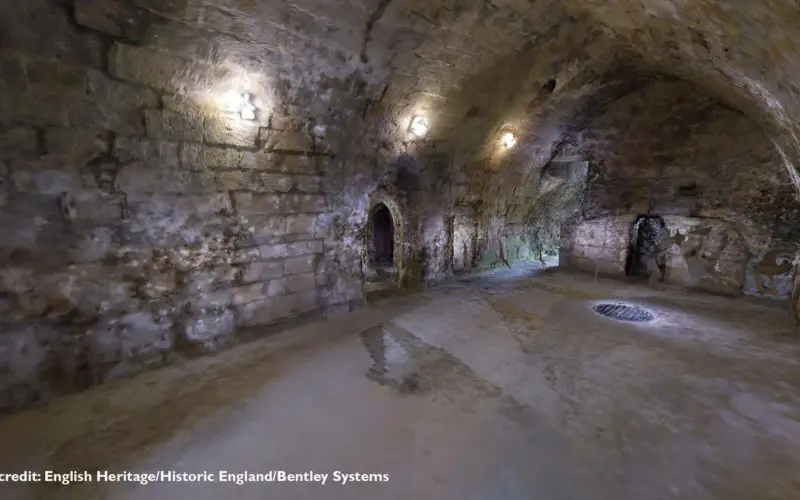
Scan images – Credit English Heritage/Historic England/Bentley Systems
Francois Valois, Senior director of software development, Bentley said, “Bentley is really excited about working with GeoSLAM to extend what is possible with both ContextCapture and ZEB-REVO. With the recent introduction of hybrid processing, it is now possible to produce reality models based on both photos and laser data. Certain environments such as indoors often prove to be a challenge for photogrammetry alone due to a lack of texture change. Hence, by using a hybrid solution it is now possible to generate accurate reality models of almost any environment.”
Through a combination of using the GeoSLAM ZEB-REVO mobile mapping system and ZEB-CAM, and the latest version of Bentley’s ContextCapturesoftware, it is now possible to produce high resolution textured reality meshes of indoor scenes, complex infrastructure and other challenging environments faster than ever before.
Through this new partnership GeoSLAM and Bentley are jointly committed to further optimise this combined workflow and to push the boundaries of what is possible in rapid mobile reality capture.
Mark Reid of GeoSLAM will be presenting the ZEB-REVO/ContextCapture solution at the Bentley ‘Year in Infrastructure’ conference 2017 taking place October 9-12 at the Sands Expo and Convention Centre, Marina Bay, Singapore.
To learn more about GeoSLAM’s rapid mobile technology, visit www.geoslam.com
About GeoSLAM
Headquartered in the UK, GeoSLAM is a global market leader in “go-anywhere” 3D mobile mapping technology. Our unique handheld technology is highly versatile and adaptable to all environments – especially spaces that are indoor, underground or difficult to access, providing accurate 3D mapping without the need for GPS.
Our technology is easy to use and within minutes’ customers can build a highly accurate 3D model of their environment. GeoSLAM was founded in 2012 as a joint venture between CSIRO (Australia’s National Science Agency and the inventors of Wi-Fi) and 3D Laser Mapping. Serving the surveying, engineering, mining, forestry, facilities and asset management sectors, GeoSLAM has an expanding network of over 50 distributors, with a presence in over 43 countries across 6 continents.
About Bentley Systems
Bentley Systems is a global leader in providing architects, engineers, geospatial professionals, constructors, and owner-operators with comprehensive software solutions for advancing the design, construction, and operations of infrastructure. Bentley users leverage information mobility across disciplines and throughout the infrastructure lifecycle to deliver better-performing projects and assets.
Founded in 1984, Bentley has more than 3,000 colleagues in over 50 countries, more than $600 million in annual revenues, and since 2011 has invested more than $1 billion in research, development, and acquisitions. Additional information about Bentley is available at www.bentley.com.