Maptitude 2020 U.S. School Districts Data Available as KML, GeoJSON, Shapefile
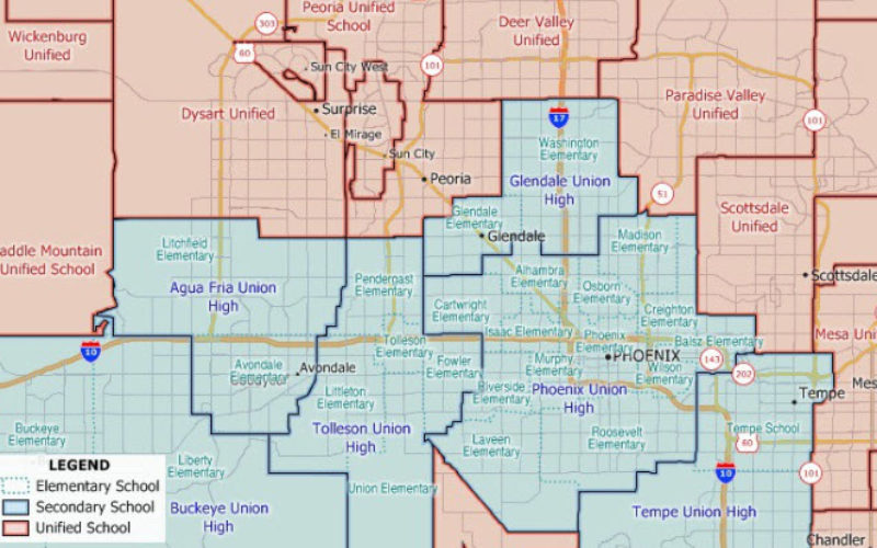
NEWTON MA (USA) – The Maptitude 2020 U.S. School Districts Data is available and includes three nationwide map layers of elementary, secondary, and unified school districts.
These districts are packed with information that is essential for analyzing school districts. Explore locations by income, population and income growth, daytime population, age, race, gender, ethnicity, buying power, occupation, employment status, housing characteristics, citizenship counts, and more.
Also included are 2014-15 statistics on the number of teachers, number of students by race (American Indian, Asian, Hispanic, Black, White, Hawaiian, Multiple races), NCES Local Education Agency ID (LEAID), State Education Agency ID, and school district name, address, phone number, and lowest and highest grades.

This wealth of data can be leveraged by data scientists and research analysts using Maptitude mapping software, a comprehensive application for data exploration.
The 2020 School Districts are priced at US$250 on the Caliper Store, and are also available as shapefile, KML, KMZ, or GeoJSON for an additional fee. If you have any questions about Maptitude or data availability contact the Maptitude team.
About Caliper
Caliper Corporation develops state-of-the-art Geographic Information Systems (GIS) software. With a focus on usability, Maptitude is designed to be a cost-effective, professional mapping software product. Maptitude enables organizations to leverage their location-based data to improve decision making and planning, while minimizing expenditure through competitively priced solutions.
Caliper is a privately held corporation and is a leading developer of mapping, redistricting, transportation, and GIS software.