Leica Webinar: Leica Captivate Pipeline: A Transformative Approach to Pipeline Surveying

Leica Captivate Pipeline: A Transformative Approach to Pipeline Surveying
Tue, Aug 8, 2017 11:00 AM – 12:00 PM PDT
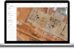
 With more than 30,000 miles of pipeline planned and under construction in North America, pipeline surveying is big business. However, the amount of reporting required to ensure that the pipelines comply with Federal Energy Regulatory Commission (FERC) regulations makes the work far from easy. The time-consuming, labor-intensive process requires numerous office technicians to handle data entry, file conversion and reconciliation, and the manually entered data must be checked and rechecked multiple times to avoid the risk of error. Working in close collaboration with leading pipeline surveying firms such as Diversified Infrastructure Services (DIS), Leica Geosystems set out to streamline the process and improve accuracy. The result is Leica Captivate Pipeline, a true end to end pipeline surveying solution.
Go behind the scenes on the development process in this 60-minute webinar with subject matter experts Jason Houle of DIS and Ted Miller of Leica Geosystems.
You’ll learn:
- What causes common challenges in the pipeline surveying workflow and how a partnership approach yielded solutions.
- How the Captivate Pipeline application ties the entire pipeline process together, from inventory to layout to data reconciliation, to achieve a 50-70% reduction in reporting time.
- How seamless integration with industry standard software provides additional time savings and increased accuracy.
- Why the results are compelling enough to transform the entire pipeline industry.
Register Now!