Leica Captivate Experience Continues with Self-learning GNSS, Dynamic Lock for MultiStations
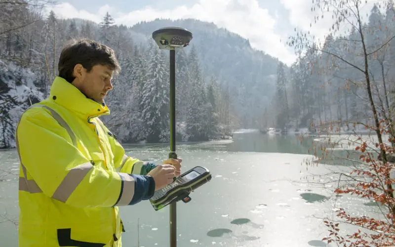
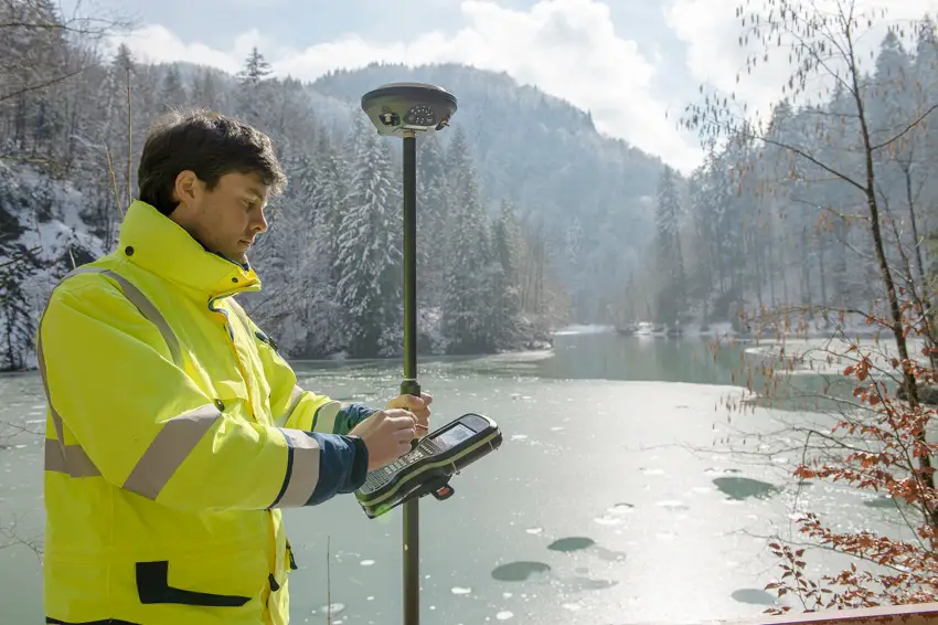
Leica Geosystems, industry leader of measurement technology, has announced the Leica Viva GS16 and updated Leica Captivate and SmartWorx Viva software. The GS16 is a truly self-learning GNSS receiver, able to automatically select the optimal combination of GNSS signals and stay connected with or without reference links.
This new release enhances the Leica Captivate Experience released last year. With the addition of self-learning GNSS, increased lock-on capability in the MultiStation and various upgrades to the immersive Captivate software, Leica Geosystems continues the focus on providing the best customer experience possible.
Introducing self-learning GNSS
With its robust 555-channel engine, the new receiver is empowered by RTKplus to access all known and current signals while intelligently distinguishing which ones are the optimal combination to lock onto for accurate positioning adapting to any environmental conditions. There is also capacity for future signals, such as the full deployment of BeiDou and the expected progress of Galileo and QZSS. Thanks to SmartLink, the precise point-positioning technology, uninterrupted positioning continues even when local corrections services are unavailable due to obstructions or lack of cellular coverage. Even when no reference data is available, SmartLink continues to enable fully remote work.
Embedded with the touch technology of the Leica Captivate measurement software, users can now bring the enjoyable 3D experience from their total stations and MultiStations directly into their GNSS workflows. Cumbersome and time-consuming calculations and conversions are no longer needed with a direct link between self-learning total stations and MultiStations and the new self-learning GNSS receiver. On a field tablet or controller, users can interact with immersive 3D models directly in the field, ensuring all data is collected and linked to the office, eliminating the need for return trips to the field.
Leica Viva GS16 Application Image
“When we developed the Viva GS16 receiver, we drew on 30 years of experience in GNSS to make the best receiver we have made to date,” said Bernhard Richter, Leica Geosystems GNSS business director. “With its flexible design, this receiver is a safe investment for the future while also bringing immediate benefits using the new GNSS signals and SmartLink.”
Upgraded software for an even more immersive experience
In addition, Leica Captivate v2.00 and SmartWorx Viva v6.00 have also been released. This upgrade brings Dynamic Lock, the increased lock-on capability of ATRplus in the MultiStation. Now significantly enlarging the search area for locking onto a moving target, the MultiStation can be used in standard surveying or high-dynamic machine control applications for better performance.
This upgrade also brings a long-range Bluetooth capability for the Leica CS35 tablet, enabling long-range control for robotic total stations and more flexibility on any site. Users can now also position and orientate a total station to any object, allowing use on a moving platform for increased mobility.

Leica Viva GS16 Application Image
Leica Geosystems
“With these improved benefits, we continue to invest in the Leica Captivate Experience to provide users with the most enjoyable time in the field and easiest analysis in the office,” said Alastair Green, software and controllers program director. “As we keep listening to customer feedback and innovating, the Leica Captivate Experience keeps getting better and better.”
For more information about the Viva GS16 GNSS receiver, please visit http://leica-geosystems.com/Viva_GS16 For more information about the upgraded Leica Captivate Experience, please visit http://leica-geosystems.com/products/total-stations/software/leica-captivate.
Leica Geosystems – when it has to be right Revolutionising the world of measurement and survey for nearly 200 years, Leica Geosystems creates complete solutions for professionals across the planet. Known for premium products and innovative solution development, professionals in a diverse mix of industries, such as aerospace and defence, safety and security, construction, and manufacturing, trust Leica Geosystems for all their geospatial needs. With precise and accurate instruments, sophisticated software, and dependable services, Leica Geosystems delivers value every day to those shaping the future of our world. Leica Geosystems is part of Hexagon (Nasdaq Stockholm: HEXA B; hexagon.com), a leading global provider of information technologies that drive quality and productivity improvements across geospatial and industrial enterprise applications.