Isro to Sign MoU with CSIR-NPL for Time and Frequency Traceability Services for NavIC
According to recent news reported by TOI, the Indian Space Research Organisation (ISRO) will on Friday sign an MoU with CSIR-National Physical Laboratory (NPL) for time and frequency traceability services.
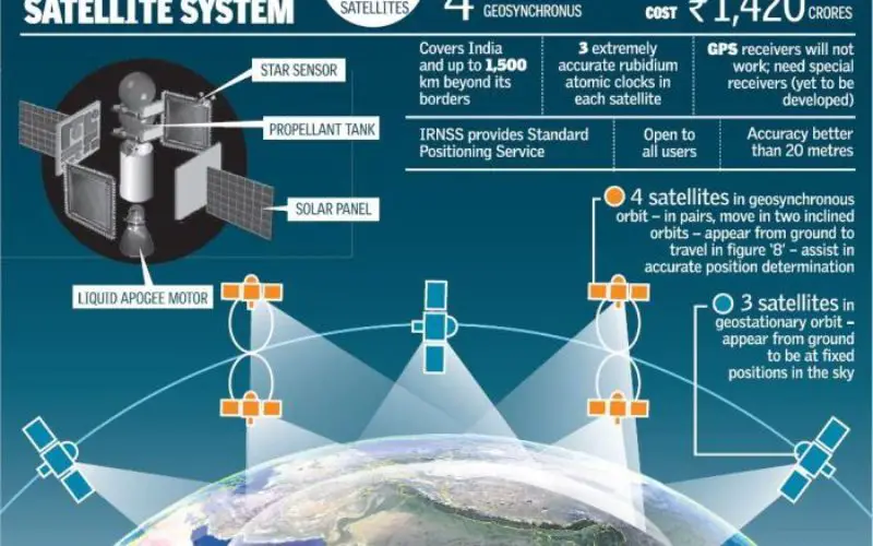
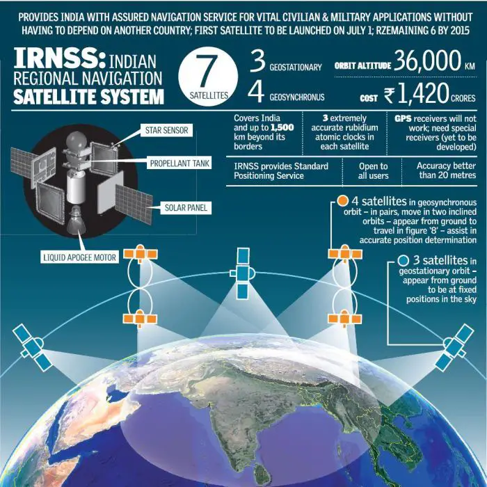
The move will help the desi GPS (NavIC – Navigation with Indian Constellation also called as IRNSS) get formally synchronized with the Indian Standard Time (IST) which is being maintained by the Delhi-based NPL – the timekeeper of India.
The step will help in making the desi GPS fully operational in the market for commercial purposes as time synchronisation is essential for all kinds of services – be it financial transactions, stock handling, digital archiving, time stamping, national security or prevention of cyber crimes.
Credit: The Gadgets Shiksha
“We can’t depend for ever on the US-based National Institute of Standards and Technology (NIST). After signing the MoU, the space clocks will be synchronised to that of the Primary National Atomic Clocks at National Physical Laboratory and therefore will have independence,” said Dinesh Aswal, director of NPL.
Though India can source the IST from the US-based NIST, the accuracy of time may vary. Aswal told TOI, “Though millisecond or microsecond accuracy is sufficient for day-to-day activities, the ISRO needs accuracy up to nanoseconds level for navigation, surveillance and other national missions.”
The NPL maintains accuracy of ±20 nanoseconds and thereby gives the most accurate time which is essential for satellite navigation system. It has the “Primary Reference Clock”, which is traceable to the Coordinated Universal Time (UTC) provided by International Bureau of Weights and Measures (BIPM) located in Sevres, France. The UTC consists of a time-scale that combines the output of more than 400 highly precise atomic clocks worldwide, including five at the CSIR-NPL.