DLR supports the United Nations World Food Programme (WFP) through satellite-based risk mapping
- DLR supports the UN World Food Programme (WFP) in a special calendar to identify environmental risks recurring in certain regions and intervals at an early stage.
- The focus is on vegetation, droughts, soil erosion as well as changes in land cover.
- The collaboration between DLR and WFP was officially inaugurated with a two-day kickoff meeting at WFP headquarters in Rome, Italy.
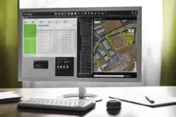
795 million people worldwide – or one in nine – do not have enough to eat. And the consequences of climate change continue to exacerbate this already precarious situation, with failed crops due to extreme periods of drought or flooding being just one example. Funded by the German Federal Foreign Office the German Aerospace Center (Deutsches Zentrum für Luft- und Raumfahrt; DLR) is now supporting WFP in the risk mapping and early detection of critical weather/climate developments to help prevent, mitigate and prepare for natural disasters as an essential part of WFP’s mandate to combat global hunger. The Spatial Risk Calendar (SpaRC), piloted by WFP’s Emergency Preparedness & Support Response Division in collaboration with the Vulnerability Analysis & Mapping Unit (VAM), aims to identify environmental risks recurring in certain regions and intervals, for instance by monitoring droughts and designing the humanitarian response to save lives.
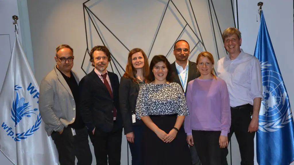
DLR and WFP Project Team
To this end, DLR is contributing its specialist experience and technical know-how in the area of remote sensing. Experts from the DLR Earth Observation Center (EOC) will analyse the data and models used by the UN until now, compare them with high-resolution satellite images and devise scientific support to further develop the system. The collaboration between DLR and WFP was officially inaugurated on 18 and 19 April 2017 with a two-day kickoff meeting at WFP headquarters in Rome, Italy. The project will continue until January 2018 with funds from the German Federal Foreign Office. The improved risk maps and calendars will be used by WFP and its partner agencies. WFP is the world’s leading humanitarian agency, supporting over 80 million people in approximately 80 countries each year – and helping to reach ‘Zero Hunger’ by 2030.
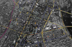
High-resolution satellite data from Sentinel-2
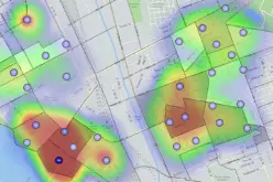
Risk calendars and maps, such as SpaRC, observe changes and recurring patterns in order to provide a global overview that is classified according to several risk factors and their short and long-term development. The focus is on vegetation, droughts, soil erosion as well as changes in land cover. The development of these environmental parameters has a direct impact on harvests and the availability of food. Heavy rainfalls for instance can cause flooding of arable land, removing its humus layers and leaving the soil infertile. Risk mapping can include particularly threatened regions, as well as the occurrence and timing of extreme weather events.
Various types of satellites will be used for the model calculations in SpaRC – those that deliver a daily image of the Earth with a resolution of 300 to 500 metres, as well as satellites that show field structures with a higher resolution of 10-20 metres, weekly or bi-weekly. In addition to the United States Landsat satellites, DLR experts will also use the satellites deployed within the European Earth observation programme Copernicus: Sentinel-2B was launched just a few weeks ago and was designed for humanitarian use. The satellite observes changes in land surfaces and vegetation continuously in a five-day cycle. Its twin, Sentinel-2A, has been providing scientists with highly precise information on the properties of plants, soils and water bodies around the globe for two years.
Fruitful collaboration
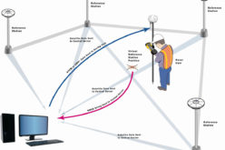
The current humanitarian risk mapping project is not the only collaboration between DLR and WFP. Recognising the growing importance of technology and innovation in the field of humanitarian assistance, DLR and WFP work together closely on other cross-cutting themes and opportunities such as automated transportation systems.