Hallowell, Maine – November 16, 2017 – Blue Marble Geographics (bluemarblegeo.com) is pleased to announce that the Global Mapper Software Development Kit (SDK) has been expanded to provide data processing capabilities in the cloud. Using Amazon Web Services (AWS), developers can utilize Global Mapper’s scripting language to provide a range of online data access, creation, editing, conversion, and distribution services for clients and customers by accessing an AWS hosted version of the SDK.
For over two decades, Blue Marble’s affordable, user-friendly GIS software has been meeting the needs of hundreds of thousands of satisfied customers throughout the world. Users come from all industries including software, oil and gas, mining, civil engineering, surveying, and technology companies, as well as government departments and academic institutions.
Global Mapper is an affordable and easy-to-use GIS application capable of displaying, converting, and analyzing virtually any type of geospatial data. The Global Mapper SDK and LiDAR Module SDK provide software developers with a toolkit for accessing much of this functionality from within an existing or custom-built application. The expansion of the SDK to include cloud data processing opens a new avenue for utilizing much of the software’s capabilities in an online environment.
The introduction of the cloud-based SDK functionality streamlines workflows by eliminating the need to transfer large volumes of data to and from a local computer – developers can now efficiently access and process data. Making use of AWS, all of the data management and manipulation procedures can now be performed on cloud servers using Global Mapper scripts. These simple ASCII- based command and parameter files are easy to create and mirror most of the functionality that is available to users of the desktop software.
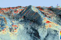
Among the procedures that can now be performed online using the Global Mapper SDK are automatic LiDAR classification, DEM creation from a point cloud, and custom contour generation. The resulting files can subsequently be saved in a defined online location or even presented in another cloud hosted application. This can be seen in the recently released 4D Mapper Geospatial Data Management Platform on AWS (www.4dmapper.com) where drone data collection can be shared directly with customers.
“One of the most important challenges facing today’s GIS data managers is the sheer volume of data that must be processed and distributed,” stated Patrick Cunningham, Blue Marble President. “Moving this workflow to the cloud eliminates many data production logjams and streamlines the flow of data. With the introduction of Global Mapper-based cloud processing, data managers can now make use of much of the desktop version’s renowned capabilities for efficient online data production.”
For more information about using Global Mapper in the cloud, visit www.bluemarblegeo.com/products/global-mapper-sdk-aws.php or email info@bluemarblegeo.com.
###
About Blue Marble Geographics: Since the early 1990s, Blue Marble Geographics has been a pioneer in the development of powerful and innovative geospatial software. Widely regarded for its expertise in coordinate conversion and file format support, Blue Marble’s products include Geographic Calculator, the paradigm for highly accurate spatial data conversion and advanced projection management; Global Mapper, a fully-functional and affordable GIS application; and the Global Mapper LiDAR Module, a suite of powerful point cloud processing tools.
Contact Information:
David McKittrick
Blue Marble Geographics
Hallowell, ME, USA
davidm@bluemarblegeo.com
800-616-2725
+1(207) 622-4622