Global Mapper v.18 Now Available with Improved User Interface and Full Range Rendering of 3D Data

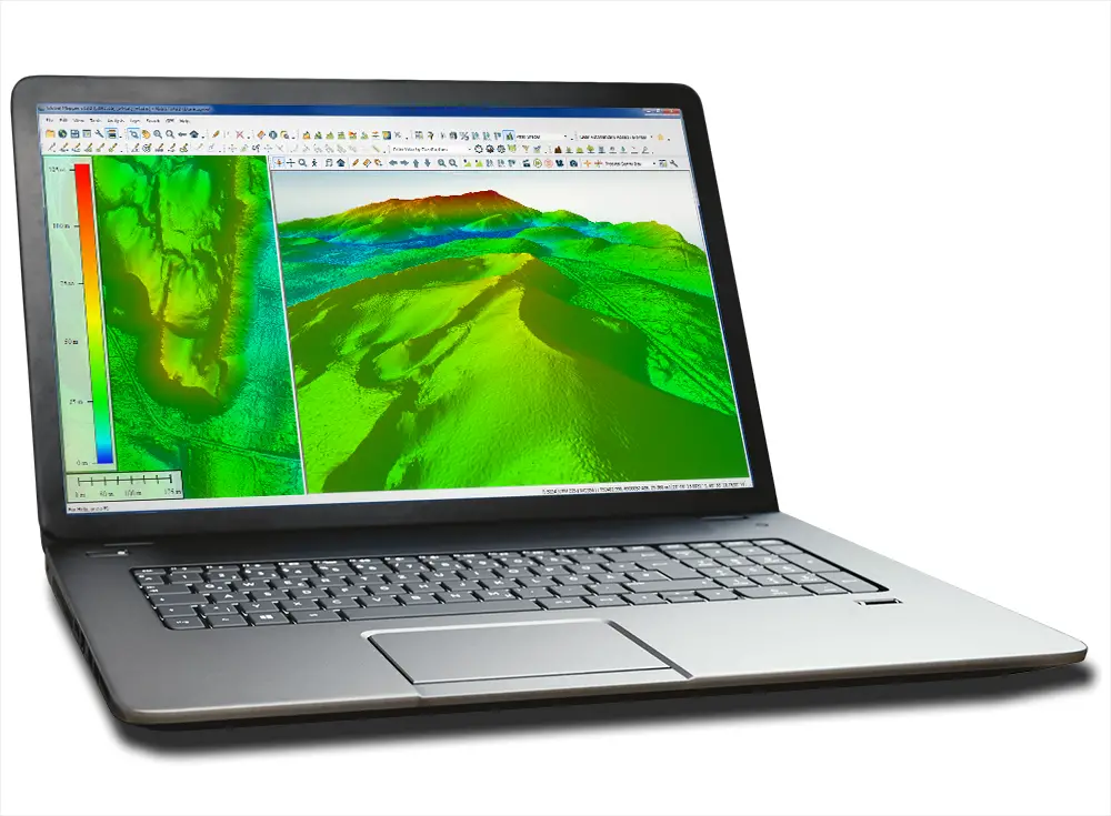
Blue Marble Geographics is pleased to announce the immediate availability ofGlobal Mapper version 18 . The culmination of an extensive design and development effort, this major version release boasts a bold new look and feel with new graphics, reconfigured menus; customizable toolbars; and improved layer management. Beyond usability upgrades, version 18 also delivers a powerful collection of functional enhancements, with a particular focus on the visualization and processing of 3D data. The 3D View now offers full range dynamic rendering of all loaded terrain or LiDAR data and supports the concurrent display of multiple terrain surfaces.
Global Mapper 18 Now Support for multiple dockable map views
Click here to download Global Mapper 18
For longtime users of Global Mapper, the most noticeable change in version 18 is the redesign of the interface along with a fresh new logo and updated button graphics. The toolbars have been reorganized to promote more efficient access to critical functionality, and each toolbar can now be customized by adding or removing buttons to reflect the requirements of each user. The toolbars can even be docked along the side or bottom of the main map window if required.
The 3D View now offers “infinite view” capability with the extent of the display encompassing all loaded 3D data. A new dynamic rendering process updates the detail level and resolution as the map is zoomed and panned. This enables the creation of truly stunning 3D data visualizations and provides the means to work with even the largest aerial or terrestrial point cloud dataset completely and natively in a 3D environment. Also within the 3D View, the updated display engine now supports the viewing of multiple surfaces, such as sequential geological bedding planes, and allows the viewing angle to be adjusted for a below-surface perspective.
Full-range terrain and LiDAR display
The release of Global Mapper also brings a new flexible licensing option for users who work on both a laptop and desktop computer. The Floating Single User License allows the license to be easily transferred back and forth facilitating both office and field work.
Blue Marble Applications Specialists will be conducting a live, interactive webinar entitled “What’s New in Global Mapper 18” on Thursday, October 6th at 2:00pm (EDT, UTC-4:00). Registration is required for this free, hour-long event and space is limited so be sure to sign up today.
For a complete list of new features and enhancements visit:
www.bluemarblegeo.com/products/global-mapper.php