 Lucknow, Jul 15, 2018 (PTI) – Use of geo-spatial techniques like remote sensing can be of immense help in identifying villages lacking in basic infrastructure and ensuring their all round development at micro-level, according to a senior scientist.
“Generation of maps on fine scale could be useful for planning developmental activities. Such type of micro-level mapping could be carried out using geo-spatial techniques like remote sensing with the high resolution satellite data, GIS and GPS technology,” said A L Haldar, acting director of the state-run Remote Sensing Applications Centre (RSAC) here.
“Mapping involves focussing on different utilities like road construction, drinking water facilities, education facilities, electricity line distribution, public toilets, construction of residential complexes, telecommunications, drainage and sewerage facility,” he told PTI.
Haldar said smart villages are the need of the hour, as rural development is one of the important missions for transforming Uttar Pradesh into a developed state.
At present, there is a wide gap in amenities and development between the urban and rural areas of Uttar Pradesh, which needs to be reduced, he said in an interview.
Keeping this in mind, Jangal Aurahi village and Baraharameer village in Gorakhpur and Maharajganj districts of Uttar Pradesh respectively were selected for the natural resources, utility facilities and infrastructure mapping.
The objective of the study also included trigger processes, which lead to holistic development of the identified villages, he said.
“This in turn will substantially improve the standard of living and quality of life of all sections of the population through improved basic amenities, higher productivity, enhanced human development, better livelihood opportunities, reduced disparities, access to rights and entitlements, wider social mobilisation and enriched social capital,” he said.
It also helps in generating models of local level development and effective local governance, which can motivate and inspire neighbouring villages to learn and adapt the similar practices in order to nurture them, he said.
Village boundaries and settlements locations were updated using the digitised maps.
This information was incorporated into the map generated through satellite data and accordingly, final utility facilities maps of each of above mentioned villages were generated, he said.
Action plan maps for soil, water resources, waste water management, solid waste management and land use management were also prepared for the favour of development of those two smart smart villages.
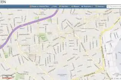
He said the web GIS services provide all the uploaded villages information in the format of map and statistics which would be very easy to handle by the decision makers and planners.
Using the application, the decision makers or planners can judiciously make use of all the facilities and amenities, Haldar said.
He said it is highly essential to give more emphasis on all round development of villages at micro level.
“Availability and optimum utilisation of natural resources, utility facilities and village infrastructures are the basic need of village population. Development and regular monitoring of these parameters are the prime objectives for uplift of any backward village,” he said.
In order to map, monitor and manage existing facilities and infrastructures of a village and to convert it into a smart village, a detailed and micro level study is required, he added.