GeoSLAM is delighted to announce the launch of Desktop V3, the latest release of their industry leading SLAM registration software.
January 31, 2017 – GeoSLAM Desktop V3 builds on the success of the popular local desktop version of their SLAM processing software that was released at the start of 2016. Whilst maintaining the simplicity and ease of use of the initial software, V3 now provides users with increased functionality to view, edit, and define results.
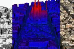
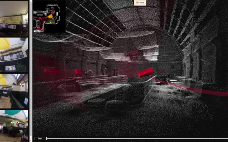
Desktop V3 now incorporates a 2D and 3D viewer such that registered point clouds can be immediately viewed without moving to third-party software. Furthermore, if the ZEB-CAM camera accessory is used, it is possible to visualize the synchronized imagery alongside the point cloud within the viewer. This additional contextual information proves incredibly valuable for feature identification within the point cloud.
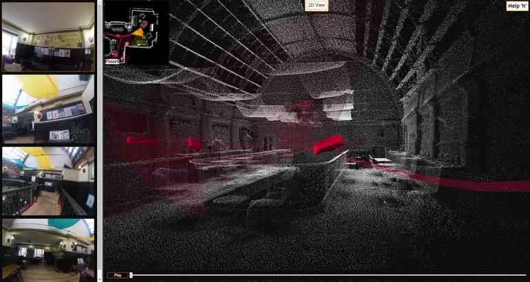
Contextual visual imagery viewed alongside the 3D point cloud in GeoSLAM Viewer
For the first time, it is now possible for users to modify and improve SLAM registration results. Following the implementation of user definable SLAM parameters, the user can now optimise processing to suit the environment in which data was collected. Users can choose from a range of parameters including bounding box size, place recognition, loop closure, and the ability to end processing early. Such advancements now put the power of data processing directly into the hands of the user.
Once point cloud registration has been optimised, Desktop V3 allows users to select from a large range of output options including format, point & spatial decimation, normal, time-stamping and point rendering. This wide array of user-defined outputs allows for ever-greater integration with third-party point cloud post processing packages.
Mark Reid, VP of Product Management at GeoSLAM, says “Our customers love the simplicity and ease of GeoSLAM Desktop, but they want more than just a SLAM processing engine. Version 3 builds upon the success of previous versions, but adds so much more functionality. For the first time, users can view, modify, and export point clouds from within the same software. We think V3 is going to be hugely popular, with existing and new customers alike.”
For more information about the new release and to download a brochure, visit the Desktop V3 page here or email info@geoslam.com