DLR Spin-off EOMAP Launches an Online Portal for UNESCO Programme on Global Indicator of Water Quality
- Worldwide mapping of water quality data for all inland and coastal waters is now possible for the first time thanks to satellite data.
- Using high-resolution remote sensing data, EOMAP has developed a portal for the International Initiative on Water Quality (IIWQ) under UNESCO’s International Hydrological Programme.
- Focus: Earth observation, space, sustainability, environmental protection, community
January 22, 2018 – EOMAP GmbH & Co. KG, a spin-off of the German Aerospace Center (Deutsches Zentrum für Luft- und Raumfahrt; DLR), presented its online portal for water quality data for all inland and coastal waters worldwide at the UNESCO headquarters in Paris.
“With the new online portal, global comprehensive water quality data are now for the first time available to government institutions, environmental authorities, the water industry and universities; these data will enable better-informed decisions to be made with regard to sustainable water management. This is yet another example of how important Earth observation is for the management of our resources; and it also includes the provision of commercial remote sensing services in an internationally growing market,” says Walther Pelzer, Executive Board Member responsible for the DLR Space Administration. The DLR Space Administration is supporting EOMAPwith funding from the German Earth observation programme for the preparation of new technologies and services relating to satellite-based remote sensing. EOMAP was founded in 2006 as a spin-off from the DLR Remote Sensing Technology Institute.
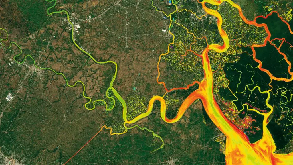
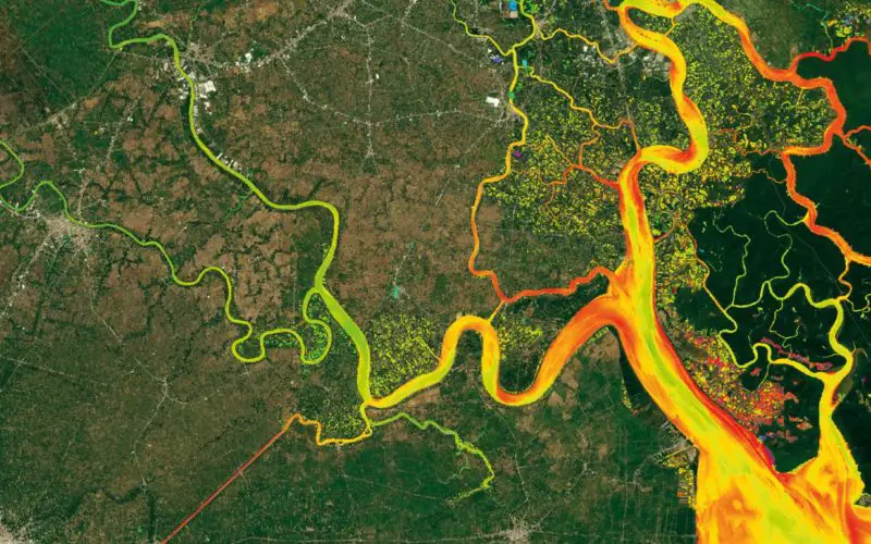
View of the World Water Quality Portal
Credit: DLR
The online portal provides parameters for unrestricted use
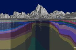
EOMAP has developed the portal for the benefit of users of map products derived from high-resolution remote sensing data relating to coastal and inland waters. The portal is part of the International Initiative on Water Quality (IIWQ) under UNESCO’s International Hydrological Programme (IHP). Via the UNESCO portal, water experts can in just a few clicks retrieve worldwide measurement data and compile time series and water reports. The satellite-derived data provide information on inland waters, rivers and lakes up to around one hectare in size. Parameters such as turbidity, chlorophyll content, water temperature and cyanobacteria indicators give a good idea of water quality.
Investment in water research
“Global water cycles are changing significantly as a result of climate change and human activity. We are seeing the effects of this in the form of natural disasters, changes in global sediment flows and excessive nutrient loads. The IIWQ World Water Quality Portal has been designed as a decision-making tool, in order to support states and regions throughout the world in their pursuit of greater commercial and environmental sustainability and in the development of innovative solutions,” explains Thomas Heege, Chief Executive Officer of EOMAP. International organisations are increasingly recognising the importance of the high-quality evaluation of waters, and are becoming aware of the gaps in their knowledge in that respect. It is for this reason that internationally comparable measurement standards are necessary, as is the availability of long-term measurement series.
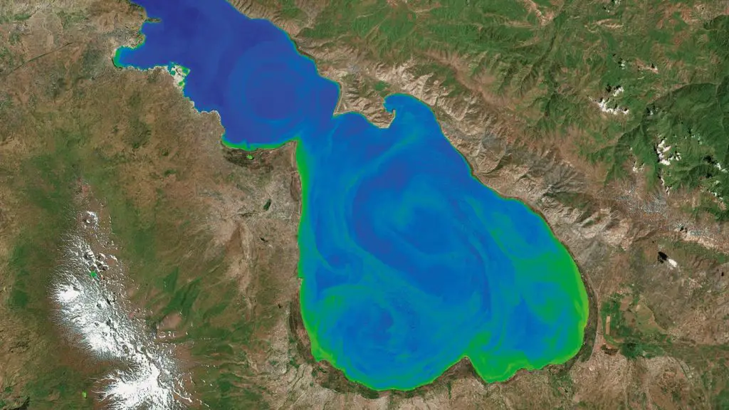
Chlorophyll Concentration in the Caucasus.
Credit: DLR
Thanks to its wide accessibility and user friendliness, the online portal will also help developing countries to build capacity and competence in their technical and administrative infrastructures. “The portal is not only an important contribution to improved global water quality information, but also promotes science- and data-based decision-making on water quality, which will lead to sustainable water resource management towards achieving the Sustainable Development Goals (SDGs). In view of scarce water quality information – both globally and nationally – the Portal will be a valuable tool to obtain water quality information, especially in remote areas and in developing regions (such as in Africa, Asia, Latin America, and Small Island Developing States) where there is a lack of water quality monitoring networks and laboratory capacity. It is also a decision-making tool and will help countries identify the most pressing water quality problems such as pollution hotpots. Hence, the portal will support national efforts for the implementation of water quality related SDG targets as well as for monitoring progress towards their realisation,” says Sarantuyaa Zandaryaa, Programme Specialist, Division of Water Sciences at IHP, UNESCO.
Satellite data are making it possible
The potential for monitoring the quality of surface waters on the basis of satellite data has expanded in recent years. “As a result of the increased availability of satellite observations, improved sensors and further development of evaluation methods, many information services have reached a high degree of maturity and are already suitable for operational use – as in this case by the United Nations,” explains Michael Nyenhuis, who is responsible for Earth observation applications in the oceans, coastal waters and inland waters sector within the DLR Space Administration.
The DLR Space Administration is currently working with EOMAP, among other things, on CODE-DE, an online platform giving users in Germany needs-based access to the data and services of the European Earth observation programme Copernicus and offering the possibility of online data processing. Using this platform it would be possible, for instance, for an enterprise to develop global water quality products without having to increase its own computing capacity, and make them available in a user-friendly form. Projects like CODE-DE form part of the German government’s Copernicus strategy adopted by the Federal Cabinet in September 2017. Only through efficient access to Earth observation data and the components of the Copernicus services will it be possible to develop reliable and innovative products.
Source: DLR