Supergeo provides GIS software on multiple platforms, including server, desktop, and mobile. Due to the rapid development of the mobile and smart devices in recent years, Supergeo has been dedicated to developing and improving mobile GIS products, like SuperSurv and SuperPad. SuperGIS Mobile Series covers most of the commonly used GIS functions like vector and raster data editing, global and custom coordinate systems support, and GPS data collection. The advanced products also include NTRIP solution, built-in or external GPS signals, and post-processing.
Supergeo X Hi-Target
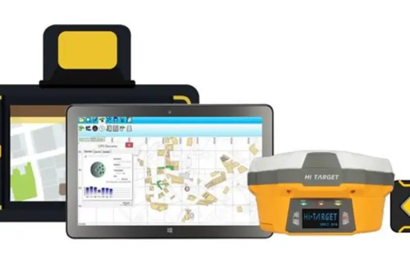
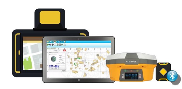
Starting from this year, Supergeo has been closely working with Hi-Target to bring our users the best GIS/GPS integration with high GPS data accuracy. Hi-Target is a global GPS provider that produces various GPS modules and GNSS RTK instruments, which can improve the GPS data accuracy to centimeter level. For many industries, accuracy does matter. For example, when surveying cadastral data, it is important to have centimeter-level precision for avoiding disputes. By combining Supergeo and Hi-Target products, users will be able to access high accuracy with various solutions. For example, if users are using Android platform, they can use SuperSurv with Hi-Target QpadX5 and CM GPS modules or QBox 8 Bluetooth GPS; or if users are using Windows/Windows Mobile platforms, they can use SuperPad with Hi-Target V100 GNSS RTK. All solutions bring you an all-in-one GIS/GPS platform.
Supergeo will continue to cooperate with Hi-Target to provide better and more solutions on GIS/GPS integration. Whether you are from cadastre industries, forests industries, or other industries that need high accuracy data collection, our solutions will be an excellent choice for you.
Experience the latest trial of SuperPad:
http://www.supergeotek.com/download_6_mobile.aspx
Contact us for more details about Supergeo X Hi-Target:
staff@supergeotek.com