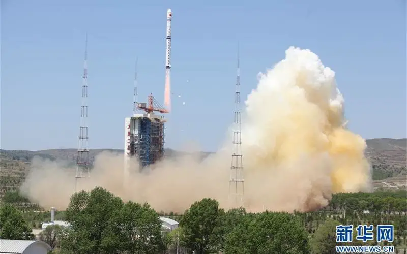
IANS – China on Monday launched a new civilian high-resolution mapping satellite from the Taiyuan Satellite Launch Centre in Shanxi province. The 2.7-tonne Ziyuan III 02 satellite soared on the back of a Long March 4B rocket at 11.17 a.m. (Beijing time), Xinhua cited the centre as saying. It was the 228th flight mission by a Long March carrier rocket.
Also on board the rocket were two NewSat satellites from Uruguay. All three satellites have successfully entered preset orbits, the Taiyuan centre said in a statement. Ziyuan III 02 will be used in land resource surveys, natural disaster prevention, agricultural development, water resources management and urban planning, among other tasks. It is the second satellite in a remote-sensing mapping system China plans to build by 2030.
![A photo shows the Ziyuan III 02 satellite has taken off from the Taiyuan Satellite Launch Center in northern Shanxi Province on May 30, 2016. [Photo: Xinhua]](http://www.gisresources.com/wp-content/uploads/2016/05/Ziyuan-III-02-satellite.jpg)
A photo shows the Ziyuan III 02 satellite has taken off from the Taiyuan Satellite Launch Center in northern Shanxi Province on May 30, 2016. [Photo: Xinhua]
It will join its predecessor Ziyuan III 01, launched in January 2012, to form a network and capture high-definition, 3-D images and multispectral data. According to Cao Haiyi, chief designer of the Ziyuan III satellites, the new satellite is able to collect 3-D images of objects 2.5 metres or longer, and reduce deviation of vertical positioning to one meter using an onboard laser range finder.
Previously, Ziyuan III 01 could only resolve to four metres in 3-D imaging and five metres in vertical measurement. Together, the two Ziyuan III satellites boast a “revisit time”, the time elapsed between observations of the same point on the Earth, of around three days, down from five to six days when only Ziyuan III 01 was operating. “Technical indicators of the Ziyuan III satellites are on par with their most advanced peers anywhere in the world,” Cao said.