
Software
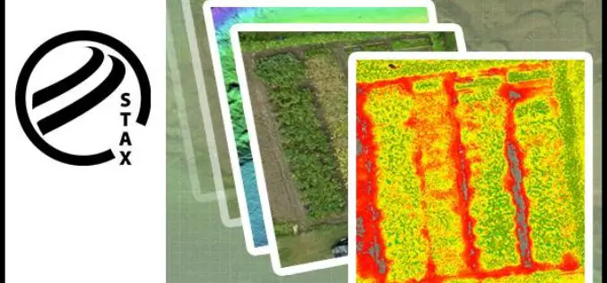
PCI Geomatics Releases STAX for UAV
MARKHAM, Ontario, Canada — March 07, 2017: PCI Geomatics, a world-leading developer of remote sensing and photogrammetric software and systems, announced today that it has released a new UAV image
Global Mapper 18.1 Now Available with Improved 3D Viewing, New Fly-Through Visualization Options, and LIDAR QC Tools
Blue Marble Geographics is pleased to announce the immediate availability of Global Mapper version 18.1. This complimentary upgrade to the version 18 release includes numerous functional enhancements throughout many areas
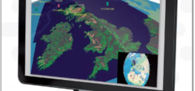
ENVITIA Launches MapLink Pro 10.0
ENVITIA is proud to announce the release of the next generation of MapLink Pro centered around the theme of speed. Speed in visualization of dynamic data, speed in the manipulation
DataMapper Releases Triangular Greenness Index App
DataMapper has recently introduced Triangular Greenness Index app in the DataMapper’s Algorithm Marketplace. Triangular Greenness Index is developed by Exogenesis, an advanced GIS and remote sensing company, the app is a highly
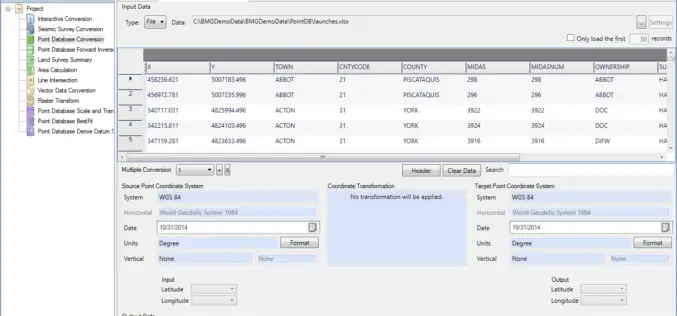
Geographic Calculator 2016 SP2 Release Coincides with the Unveiling of the New Cloud-Based Online GeoCalc Geodetic Registry
Blue Marble Geographics is pleased to announce the immediate availability of Geographic Calculator 2016 Service Pack 2 (SP2). This release includes numerous improvements to the usability of the software; updates
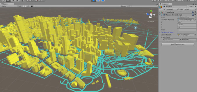
Mapbox Announces Unity SDK
Nov 10, 2016 – Today Mapbox has announced the new Unity SDK giving developers direct access to Mapbox from within Unity, bringing the full spectrum of Mapbox API’s to location-based

Global Mapper LiDAR Module v18 Now Available with Full Range 3D Point Cloud Display
Blue Marble Geographics is pleased to announce the availability of an update to the Global Mapper LiDAR Module. Released in conjunction with Global Mapper version 18 the latest edition of

PDF3D Announces Support for macOS Sierra
Advanced 3D PDF authoring software suite supports the latest Macintosh® OS release. London, UK, October 27th, 2016 – PDF3D, from Visual Technology Services, today reaffirmed its commitment to Apple technology

DataMapper Launches New Drone Data App – Waterpooling App
In the aftermath of an extreme rain event, insurance adjusters and growers have had to spend a significant amount of time in the field to approximate the extent of damage.
Mapbox Added 3D features in Mapbox GL JS
Mapbox added 3D features to Mapbox GL JS to take your maps to new heights! With the new extrusion properties, we can render 3D buildings/3D visualizations, visualize elevation profiles, build
