
Software
PCI Geomatics Releases Geomatica 2017, Service Pack 1
MARKHAM, Ontario, Canada, September 12, 2017 – PCI Geomatics, a world leading developer of remote sensing and photogrammetric software and systems, announced today the release of Service Pack 1 for
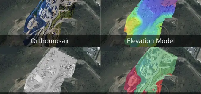
3 New Elevation Viewers, Now in Site Scan
August 9, 2017 – One of the most common uses for Site Scan is performing topographic surveys: you can use a drone to survey your site faster, safer, and more cost-effectively,

TerraGo Mobile Apps Add New Advanced Mapping Features and Laser Range Finder Integration
TerraGo Mobile Apps Add New Advanced Mapping Features and Laser Range Finder Integration TerraGo Edge 4.1 and any app created with the TerraGo Magic zero-code app platform includes enhanced mapping and surveying features

Embarcadero and TatukGIS Announce New Tool for RAD Studio
Latest geographic information system development kit allows RAD Studio developers to create desktop, client-server and mobile GIS apps AUSTIN, Texas–(BUSINESS WIRE)–Embarcadero Technologies (a division of IDERA) and TatukGIS today announced that TatukGIS has released
USGS Releases New JavaScript Library to Create Location Search Widgets for Web Applications
The U.S. Geological Survey Search API is a custom JavaScript library useful for creating a location search widget in a webpage, typically in conjunction with a web map. The widget connects to
Trimble Introduces New Android Application for Field Surveying and Data Collection
Easy-to-Use Trimble Penmap for Android Simplifies Field Work SUNNYVALE, Calif., July 26, 2017—Trimble (NASDAQ: TRMB) introduced today Trimble® Penmap® for Android™, a cloud-connected application for field surveying and high-accuracy Geographic
LandScape 7.4: Faster Point Cloud Loading, Change Detection Tools & VR Option
DAT/EM Systems International Updates Landscape Software to Deliver Faster Point Cloud Loading and Change Detection Tools Version 7.4, with Virtual Reality Option, to be Demonstrated at Esri Events in San

Global Mapper LiDAR Module v18.2 Now Features Hydro-Flattening Capability
Blue Marble Geographics has recently announced the release of Global Mapper version 18.2, the latest edition of the Module includes support for hydro-flattening from 3D lines or polygons when creating
Spanish Language Version of Global Mapper Now Available
Hallowell, Maine – June 19, 2017 – Blue Marble Geographics (www.bluemarblegeo.com) is pleased to announce that a Spanish language version of Global Mapper is now available. Developed in partnership with the company’s certified
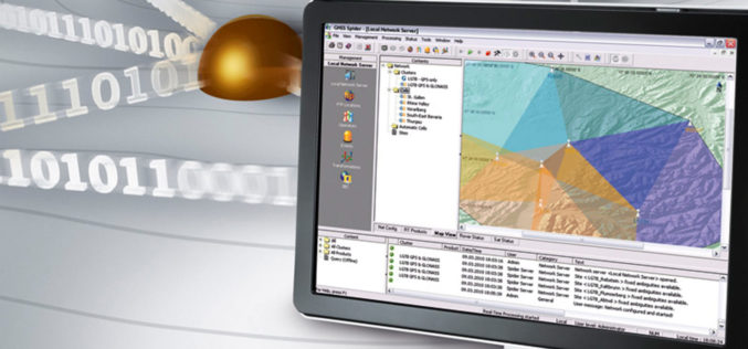
Leica Geosystems’ GNSS Networks Now Support Galileo, QZSS
(Heerbrugg, Switzerland, 16 June 2017) Leica Geosystems, industry leader in measurement technology, released Leica Spider v7.0 software suite, supporting Galileo and QZSS constellations as well as the GPS-L5 signal for
