
Software
Latest SuperSurv 3.2 Boosts Convenience of Geospatial Data Collection
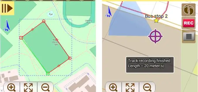
Developed by Supergeo, the latest version of SuperSurv (iOS/Android) 3.2 is upgraded with more global coordinates systems functions to bring users a more convenient and intuitive manipulation. SuperSurv, the mobile

Topcon Adds Imaging Capability to DS-200 Total Station Series
Topcon Positioning Group announces the addition of imaging capability to its direct aiming line of motorized total stations. The DS-200i provides real-time, touch-screen video and photo imaging to capture measured

Introducing the MapBox Surface API
Mapbox Surface API: it’s a remarkable new way to access raw data behind a map. Using Mapbox Vector Tiles, the Surface API can look at elevation profiles to crime indices

Trimble Adds Satellite Imagery Data Support and Automation for Photogrammetry and Remote Sensing Professionals
BERLIN, Oct. 7, 2014—Trimble (NASDAQ: TRMB) announced today a new version of its photogrammetric software suite—Inpho® version 6.0, which provides highly automated workflows for photogrammetry and remote sensing professionals so

Kedarnath Pilgrims to Get Weather Updates On Phone
Dehradun: Drawing lessons from 2013 calamity at Kedarnath which caught thousands of pilgrims offguard, the state government has completed the digital mapping of Rudraprayag district which will help pilgrims heading for the Himalayan shrine

SimActive Introduces Game-Changing Technology for Mosaic Creation
SimActive Inc., a world-leading developer of photogrammetry software, is pleased to announce Correlator3D™ version 5.4, with significantly faster mosaic creation and a further increase in quality. The process has been
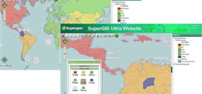
Supergeo Releases SuperGIS Spatial Analyst 3.2
Supergeo Technologies, the global leading GIS software and solution provider, releases the latest SuperGIS Spatial Analyst 3.2 for worldwide SuperGIS Desktop 3.2 users to experience more advanced spatial analysis functions.

Ordnance Survey’s new Minecraft Map Offers Greater Gaming and Learning Possibilities
Exactly a year on from the release of GB Minecraft, Ordnance Survey has launched GB Minecraft 2. This free-to-download Minecraft map offers gamers a much more natural-looking and detailed version of

Global Mapper V16 Released with 3D Tools Including HD Fly-Through
Blue Marble Geographics (bluemarblegeo.com) is pleased to announce the release of Global Mapper version 16. This major release includes many significant updates and new tools for working with 3D data.
The Latest SuperGIS Server 3.2 Upgraded for Enhanced Service Management and Efficiency
The newest version of SuperGIS Server 3.2, developed by Supergeo, is now launched to global users. The new edition provides enhanced user interface and service management workflow, to assist developers
