
Research Papers
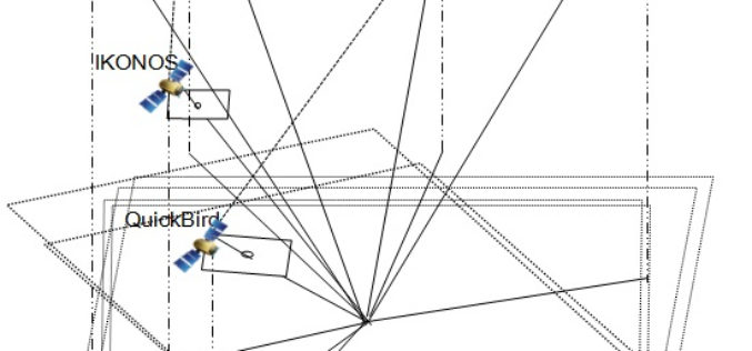
Geo Positioning Accuracy Using Multiple-Satellite Images: IKONOS, QuickBird, and KOMPSAT-2 Stereo Images
Geo-Positioning Accuracy Using Multiple-Satellite Images: IKONOS, QuickBird, and KOMPSAT-2 Stereo Images – Jaehoon Jeong, Chansu Yang and Taejung Kim Abstract: This paper investigates the positioning accuracy of image pairs achieved by integrating images
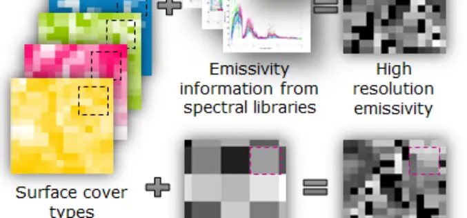
Urban Surface Temperature Time Series Estimation at the Local Scale by Spatial-Spectral Unmixing of Satellite Observations
Urban Surface Temperature Time Series Estimation at the Local Scale by Spatial-Spectral Unmixing of Satellite Observations – Zina Mitraka, Nektarios Chrysoulakis, Georgia Doxani, Fabio Del Frate and Michael Berger Abstract: The study of urban
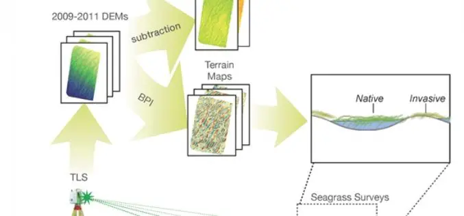
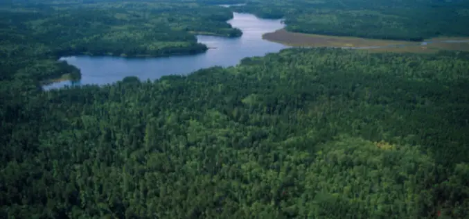
Terrestrial Laser Scanning Reveals Seagrass Microhabitat Structure on a Tideflat
Terrestrial Laser Scanning Reveals Seagrass Microhabitat Structure on a Tideflat – Michael Hannam and L. Monika Moskal Abstract: Local-scale environmental heterogeneity can provide microhabitats that influence the spatial distribution of competing species.
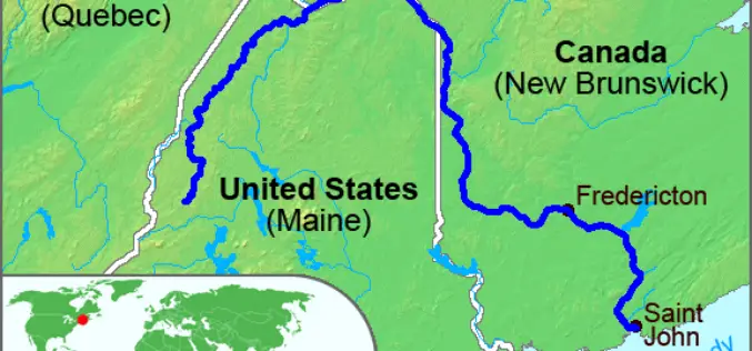
High-Precision Land-Cover-Land-Use GIS Mapping and Land Availability and Suitability Analysis for Grass Biomass Production in the Aroostook River Valley, Maine, USA
High-Precision Land-Cover-Land-Use GIS Mapping and Land Availability and Suitability Analysis for Grass Biomass Production in the Aroostook River Valley, Maine, USA – Chunzeng Wang , Jason Johnston, David Vail, Jared Dickinson and
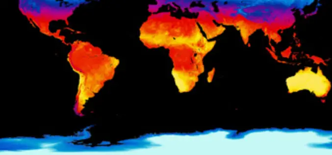
Estimation and Validation of Land Surface Temperatures from Chinese Second-Generation Polar-Orbit FY-3A VIRR Data
Estimation and Validation of Land Surface Temperatures from Chinese Second-Generation Polar-Orbit FY-3A VIRR Data – Bo-Hui Tang, Kun Shao , Zhao-Liang Li, Hua Wu, Françoise Nerry and Guoqing Zhou Abstract: This work estimated and validated
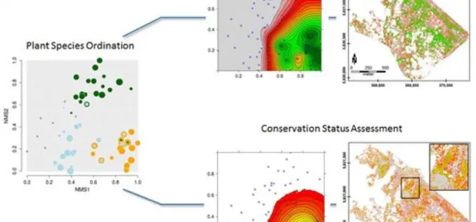
Gradient-Based Assessment of Habitat Quality for Spectral Ecosystem Monitoring
Gradient-Based Assessment of Habitat Quality for Spectral Ecosystem Monitoring – Carsten Neumann , Gabriele Weiss, Sebastian Schmidtlein, Sibylle Itzerott, Angela Lausch, Daniel Doktor, and Maximilian Brell Abstract: The monitoring of ecosystems alterations has become a crucial
Regional Equivalent Water Thickness Modeling from Remote Sensing across a Tree Cover/ LAI Gradient in Mediterranean Forests of Northern Tunisia
Regional Equivalent Water Thickness Modeling from Remote Sensing across a Tree Cover/LAI Gradient in Mediterranean Forests of Northern Tunisia – Hedia Chakroun, Florent Mouillot and Abdelaziz Hamdi Abstract: The performance of
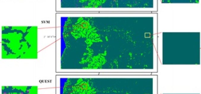
Mapping Oil Palm Plantations in Cameroon Using PALSAR 50-m Orthorectified Mosaic Images
Mapping Oil Palm Plantations in Cameroon Using PALSAR 50-m Orthorectified Mosaic Images -By: Li Li, Jinwei Dong, Simon Njeudeng Tenku and Xiangming Xiao Abstract: Oil palm plantations have expanded rapidly. Estimating either positive
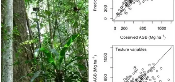
Modeling Aboveground Biomass in Dense Tropical Submontane Rainforest Using Airborne Laser Scanner Data
Modeling Aboveground Biomass in Dense Tropical Submontane Rainforest Using Airborne Laser Scanner Data – Endre Hofstad Hansen, Terje Gobakken, Ole Martin Bollandsås, Eliakimu Zahabu and Erik Næsset Abstract: Successful implementation of projects
Retrieval of a Temporal High-Resolution Leaf Area Index (LAI) by Combining MODIS LAI and ASTER Reflectance Data
Retrieval of a Temporal High-Resolution Leaf Area Index (LAI) by Combining MODIS LAI and ASTER Reflectance Data – Yonghua Qu , Wenchao Han and Mingguo Ma Abstract: This paper
