
Remote Sensing

China to Build Comprehensive EO System in 10yrs
Beijing: China plans to build an earth observation system that integrates use of air, space and ground based technology, including drones, satellites and GPS systems in the next ten years, a top
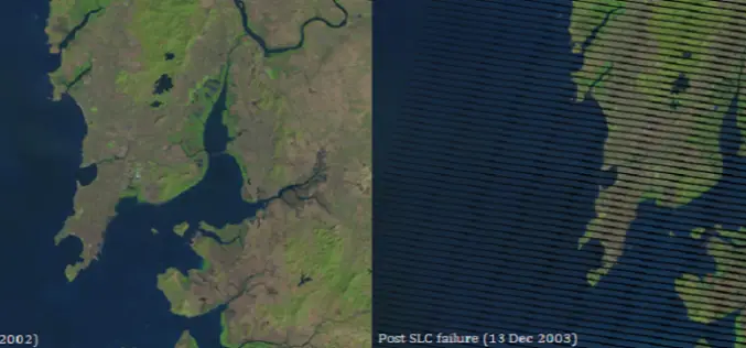
Gap-Filling Landsat 7 SLC-off data using ERDAS and ENVI
On May 31, 2003, the Scan Line Corrector (SLC), which compensates for the forward motion of Landsat 7, failed. Subsequent efforts to recover the SLC were not successful, and the

India Sings MoU with China on Peaceful Use of Space
September 20, 2014: In a visit to India, Chinese President Xi Jinping signed a series of documents with India at the Hyderabad House in New Delhi, strengthening ties between the
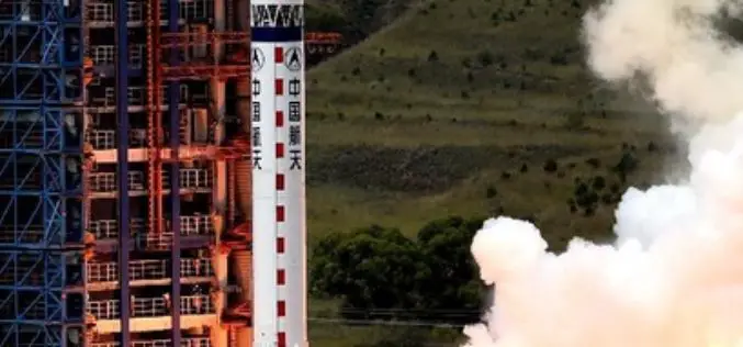
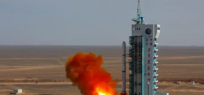
China Launches Remote Sensing Satellite – Yaogan-21
In recent news,China has successfully launched Yaogan-21, a remote sensing satellite on September 8, 2014 from Taiyuan Satellite Launch Centre. A Long March-4B carrier rocket carries Yaogan-21 and Tiantuo-2 satellite,
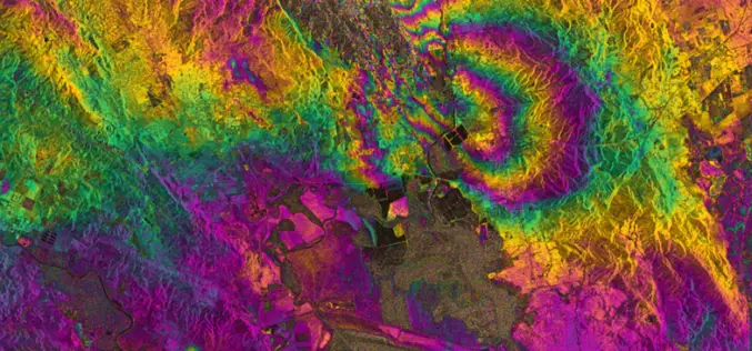
RADAR Vision Maps Napa Valley Earthquakes
Sentinel-1A has added yet another string to its bow. Radar images from this fledgling satellite have been used to map the rupture caused by the biggest earthquake that has shaken

First images taken with Exelis system on DigitalGlobe’s WorldView-3 satellite released
Exelis-built integrated super-spectral imaging system consists of a telescope, sensor and shortwave infrared system ROCHESTER, N.Y., Aug. 26, 2014 – DigitalGlobe has released the first images taken with the Exelis-built (NYSE: XLS) integrated,
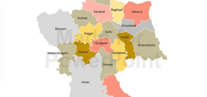
Decline in Natural Conservation Zones in NCR: Govternment
New Delhi: Natural conservation zones (NCZs) like forests, water bodies and waste lands have declined in the National Capital Region, Lok Sabha was informed on Wednesday. As per the analysis
Geospatial Analysis of Biomass in Lake Region of Kumaun Himalaya, Uttarakhand
Abstract The present study includes vegetation and forest biomass mapping in the lake region of Kumaun, Uttarakhand, using IRS1C LISSIII satellite data. A total of 11 forest types including forest

Stunning Images of UAE by DubaiSat-1
According to recent news, DubaiSat-1 (Launched in 2009) has captured all pictures of the Emirates Atlas and still operating efficiently and has now been in space service for five years.
China Successfully Launches Remote Sensing Satellite
BEIJING: China today successfully launched a remote-sensing satellite to carry out scientific experiments and provide early alerts about natural disasters. The Yaogan XX satellite blasted off at 1:45 pm local time on the back of a Long
