
Business

Cornerstone Mapping Processing Thermal Imagery with SimActive
SimActive Inc., a world-leading developer of photogrammetry software, is pleased to announce purchase of Correlator3D™ by Cornerstone Mapping Inc. Based in the U.S., they are primarily using the software to

What’s New in ArcGIS Online June Release
The June update of ArcGIS Online features improvements to item pages, updated content, and more options for administrators. Improved Item Pages Check out the redesign. It includes better work flows,

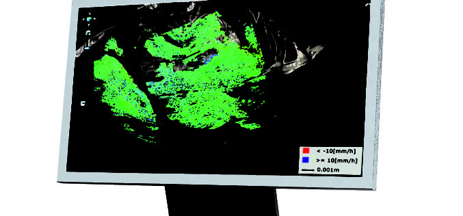
Leica Geosystems Expands LiDAR Capabilities in ALS80 Airborne Sensor
(Heerbrugg,Switzerland/Anaheim, California, USA, 16 June 2016) – Leica Geosystems, global leader of measurement and reality capture technologies, today announced it has expanded functionality of the popular ALS80 airborne sensor that
Leica Geosystems Establishes Georadar Portfolio
(HEERBRUGG, SWITZERLAND, 15 June 2016) – Leica Geosystems, global leader of measurement and reality capture technologies, today announced the establishment of a georadar portfolio with three releases to provide applications

concept3D Announces Launch of atlas3D Mapping and Interactive Media Platform
Convention centers, commercial real estate, health centers and other facilities tap atlas3D to engage visitors and profile their spaces online The concept3D team is excited to announce the launch of atlas3D, a powerful
INTERGEO 2016 – Conference Programme Online
Karlsruhe, 16June 2016|“The topics being covered are as diverse as the geo community itself,” says Professor Karl-Friedrich Thöne, President of the DVW, describing the INTERGEO conference programme, which has just

NGCC and Esri Provide Access to Authoritative Chinese Cartographic Maps and Imagery
Redlands, California—The world’s leading mapping platform company, Esri, and the National Geomatics Center of China (NGCC) held a signing ceremony in Beijing, China with respect to providing access to NGCC’s
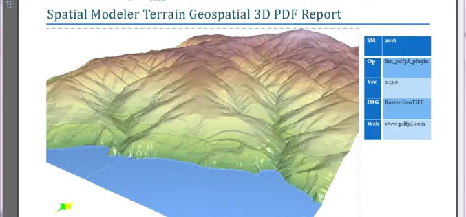
PDF3D Releases 3D Geospatial PDF Plugin for ERDAS IMAGINE at HxGN Live
PDF3D Plugin Released to Create High Quality Geospatial 3D PDF Documents from within ERDAS IMAGINE Spatial Modeler 2016. Anaheim California, June 13th, 2016 – Technological leaders, PDF3D, have today announced

Hexagon Launches HxGN SMART Build, a Pioneering Enterprise Construction Management Software Solution
Hexagon AB, a leading global provider of information technologies that drive productivity and quality across geospatial and industrial enterprise applications, today announced the launch of HxGN SMART Build, an enterprise

Esri and Hexagon Promote Their Joint Collaboration at HxGN LIVE
Redlands, California—June 14, 2016—In 2015, Esri and Hexagon jointly announced a series of ready-to-use imagery services to Esri users through the ArcGIS Market Place. The ArcGIS Market Place delivers high-resolution
