
Business
New World Bank Tool Helps Map Solar Potential
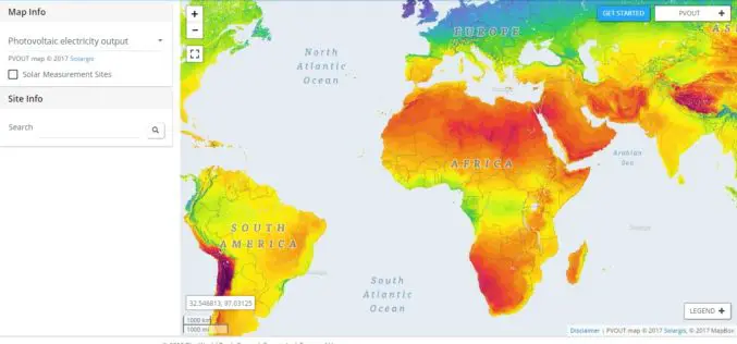
ABU DHABI, January 17 — The World Bank, in partnership with the International Solar Alliance (ISA), launched the Global Solar Atlas, a free, web-based tool to help investors and policymakers identify potential
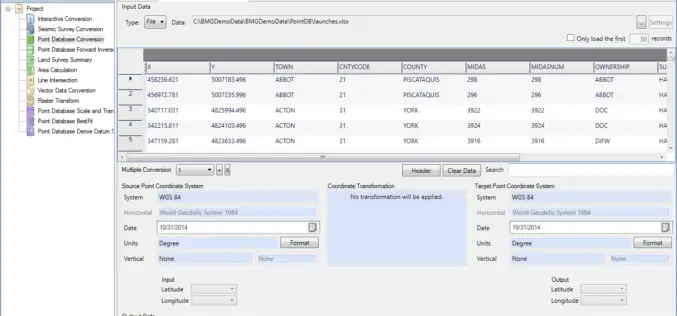
Geographic Calculator 2016 SP2 Release Coincides with the Unveiling of the New Cloud-Based Online GeoCalc Geodetic Registry
Blue Marble Geographics is pleased to announce the immediate availability of Geographic Calculator 2016 Service Pack 2 (SP2). This release includes numerous improvements to the usability of the software; updates

OGC Seeks Public Comment on OGC WaterML 2 – Part 3, Surface Hydrology Features Conceptual Model
The membership of the Open Geospatial Consortium (OGC®) seeks public comment on its WaterML 2 – Part 3, Surface Hydrology Features Conceptual Model. The OGC WaterML 2 – Part 3,
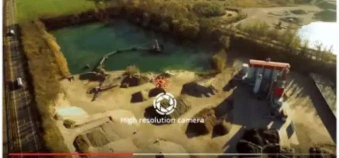
5 Drones for Precision Agriculture on Geo-matching.com
Drones (also known as Unmanned Aerial Vehicles) are used for various applications such as surveying, surveillance and habitat mapping. An interesting new application is precision agriculture. Drones can be used

PCI Geomatics Announces Collaboration with Deimos Imaging to Support the PanGeo Alliance
MARKHAM, Ontario, Canada—January 10, 2017: PCI Geomatics, a world-leading developer of remote sensing and photogrammetric software and systems, announced today it will be collaborating closely with Deimos Imaging to support
Esri Shares a Vision for the Connected Car at CES 2017
Experience the Future of Connected Driving at CES with Microsoft, Esri, NXP, IAV, Cubic Telecom, and Swiss Re Redlands, California—Esri, the global leader in spatial analytics technology, announced its participation
Woolpert Contracted to Collect Orthoimagery for Ohio
COLUMBUS, Ohio (Jan. 4, 2017) — Woolpert has been contracted to acquire high-resolution orthoimagery for the entire state of Ohio, which is roughly 41,276 square miles, by the Ohio Geographically

Avenza MAPublisher Now Features ArcGIS Online Integration within Adobe Illustrator
Connect to ArcGIS Online within Adobe Illustrator to import and work with data layers Toronto, ON, January 4, 2017 – Avenza Systems Inc., producers of the Avenza Maps app for

Project X Labs Makes Location Intelligence Intuitive With Geodash 3.2
Fully Compatible With Microstrategy 10.6 and Now Bundled With Intellisite TORONTO, ON–(Marketwired – January 03, 2017) – Project X Labs Ltd. is pleased to present GeoDash™ 3.2 and GeoDash™ 3.2M

Bracknell Forest Homes Drives More Benefits From GIS
Bracknell Forest Homes is using a GIS for digital transformation and to create new streamlined processes. The GIS helps the business from reducing under-occupancy rates to helping find new development opportunities, and it now
