
Business

Jesi, Historic City in Italy Uses SuperSurv to Collect Spatial Data
Supergeo Technologies, the worldwide GIS software and solution provider is pleased to announce that Jesi City selects SuperSurv to collect spatial data. Located in central Italy, Marche Region, Jesi is
Indonesian Mining Company Adaro Selects SuperSurv
Supergeo is glad to announce that PT Adaro Indonesia has selected SuperSurv to assist spatial data collection in the field. Founded in 1982, Jakarta, PT Adaro Indonesia is the core

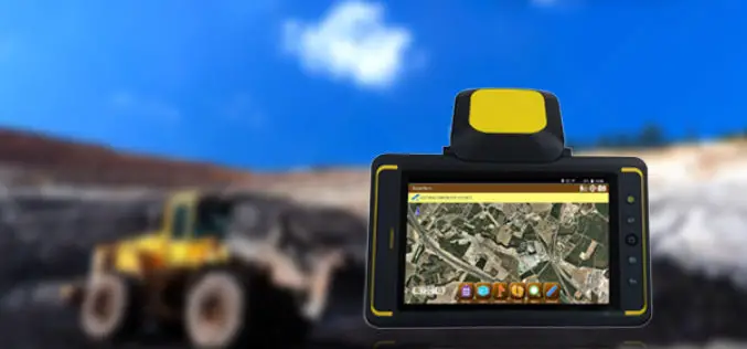
Supergeo Unveils SuperPad 10 Beta
Supergeo Technologies Inc. is excited to announce the beta version of SuperPad 10, its most popular mobile GIS software based on Windows and Windows Mobile OS, has been released at

PCI Geomatics Joins UK’s Geologic Remote Sensing Group (GRSG)
MARKHAM, Ontario, Canada, February 08, 2017 — PCI Geomatics, a world leading developer of remote sensing and photogrammetric software and systems, announced today it has joined the UK’s Geologic Remote
DigitalGlobe Adds New, Innovative Partners to Its Rapidly Growing Geospatial Big Data Ecosystem
WESTMINSTER, Colo.–(BUSINESS WIRE)–Feb. 7, 2017– DigitalGlobe, Inc. (NYSE: DGI), the global leader in Earth imagery and information about our changing planet, announced the growth of its ecosystem of content producers

Leica Geosystems Partners with Geolantis to Integrate a Cloud Based Utility Mapping Platform
(Heerbrugg, Switzerland; Klagenfurt, Austria, 8 February 2017) – Leica Geosystems, global leader of measurement and digital reality capture technologies, has teamed with Geolantis, a provider and developer of the best-in-class

How Geospatial Characteristics Affect Those Most Affected by HIV
PHILADELPHIA (February 6, 2017) – Young men who have sex with men (YMSM), particularly racial/ethnic minorities and youth living in socioeconomically disadvantaged communities, are disproportionately affected by the human immunodeficiency

OGC to Initiate Phase 1 Development of Interoperability Standards for Underground Infrastructure Data
7 February 2017 – The Open Geospatial Consortium (OGC®) is pleased to announce that the Fund for the City of New York and its sister organization, the National Center for Civic
OmniEarth Applies Machine Learning to Multiple Satellite Sources for Improved Soil Moisture Mapping
The US Defense Advanced Research Projects Agency (DARPA) has awarded OmniEarth a Small Business Innovation Research (SBIR) Phase I contract to develop a precision soil moisture mapping model in support
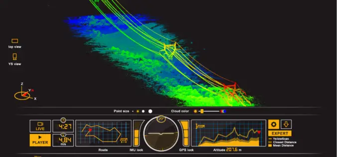
ILMF 2017: YellowScan Launches YellowScan LiveStation
ILMF 2017: YellowScan launches YellowScan LiveStation, Real-time in-flight LiDAR Station, a must for long endurance and critical LiDAR flights Yellowscan is very pleased to announce the launch of the YellowScan
