
Business

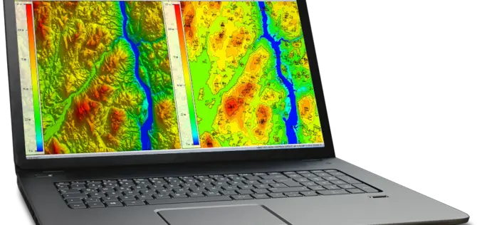
New Tool Allows Users to Explore Mountains Worldwide
A new tool that gives users the most detailed view yet of the world’s mountains is now available from the USGS. And it’s as close as your computer or cellphone.

AIR Worldwide Expands Its Inland Flood Modeling Capabilities to Japan
Release of Touchstone Version 5.1 includes new geospatial features BOSTON, Oct. 23, 2017 — Catastrophe modeling firm AIR Worldwide has introduced a new inland flood model for Japan along with
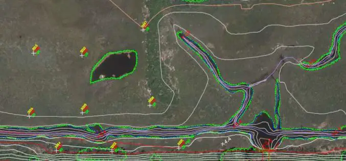
Global Mapper and LiDAR Module SDK v19 Released with Expanded Online Data Support and Improved LiDAR Ground Point Detection and Reclassification
Hallowell, Maine – October 17, 2017 – Blue Marble Geographics (www.bluemarblegeo.com) is pleased to announce the immediate availability of version 19 of the Global Mapper Software Development Kit (SDK) along with

UrtheCast and e-GEOS Collaborate to Offer Unique Optical and SAR Products
Madrid, October 20, 2017 – UrtheCast Corp., its subsidiary Deimos Imaging and e-GEOS (a company owned by Telespazio and the Italian Space Agency)today announced a strategic partnership to offer a
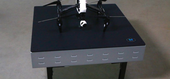
WiBotic Announces WiBotic PowerPad, the First Autonomous Wireless Charging Pad for Drones
New Wireless Charging Pad is Perfect for Mounting on Rooftops and Other Elevated Outdoor Structures; or Indoors for Drones Used in Factory or Inventory Management Seattle, WA—October 18, 2017—WiBotic, a

PDF3D Work With Forensics to Bring 3D PDF into the Court Room
3D PDF conversion software leaders, PDF3D, have today released a new eBook that will help forensic investigators and engineers improve presentation of evidence and 3D reconstructions in court. London, October
NavVis Partners with PrecisionPoint to Bring the American Indoors Online
13 October 2017 – NavVis, the global leader in indoor mapping, visualization, and navigation, announces a new partnership with PrecisionPoint, a leading reality capture solutions provider in the USA. PrecisionPoint is
Airborne LiDAR Production Now Fully Integrated With Leica HxMap Workflow
Leica Geosystems, industry leader for reality capture and measurement technology, announced today the release of LiDAR data processing capability in the Leica RealCity solution package. Leica Geosystems partnered with international asset
Hexagon Acquires Luciad, a Leading Provider of 5D Visualisation and Analysis Solutions
04 October 2017 – Stockholm, Sweden – Hexagon AB, a leading global provider of information technologies that drive productivity and quality across geospatial and industrial enterprise applications, announces the acquisition of Luciad,
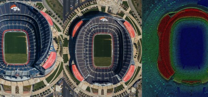
Col-East Taps Extensive Image Archive to Create Multi-Function Maps
NORTH ADAMS, Massachusetts, 4 October 2017 – Col-East International Ltd., a provider of aerial photogrammetric services in the Northeast U.S. since 1952, tapped into its extensive archive of aerial imagery
