
Business

Bluesky LiDAR Data Used by RPS to Assess Flood Risk for Anglian Water
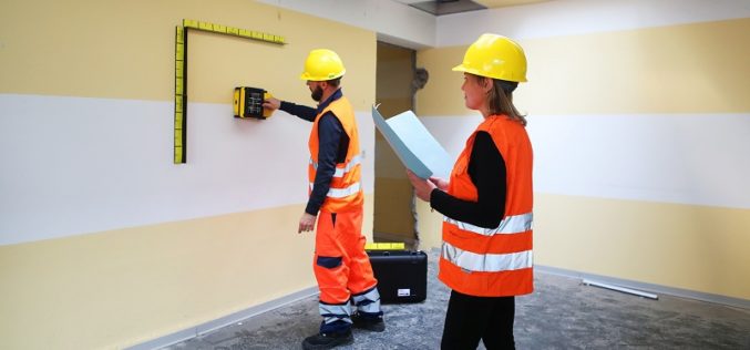
November 1, 2017 – A sewer flood risk map of the Anglian Water region is being created by the Wastewater Consultancy team of RPS. The highly accurate 3D digital map
Calspan Invests in the Future of Drone Technology
Adding another aircraft to an ever-growing fleet allows Calspan to better address the needs of an evolving customer base. Buffalo, New York – October 31, 2017 – Calspan is pleased to
GPSdome to Announce GPS Anti-Jamming & Anti-Spoofing Antenna Module Solution for Timing Systems at ITSF
CAESAREA, Israel, October 30, 2017 /PRNewswire/ — GPSdome Ltd., the Cyber Company, announced the release of its new product, GPSdome 1.0 Model T, which provides GPS anti-jamming and anti-spoofing protection for GPS-based timing systems.
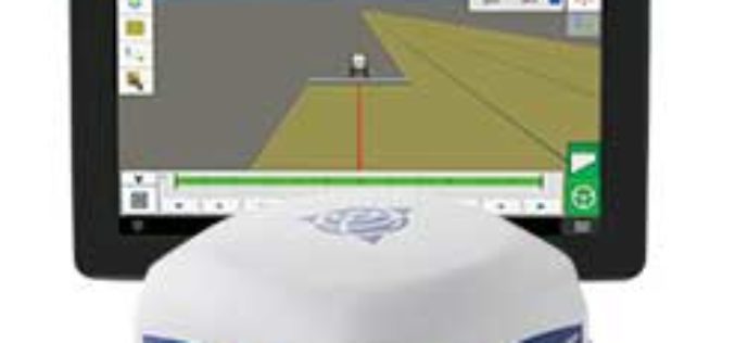
Trimble Introduces ISOBUS-Compatible GFX-750 Display System with Advanced Guidance Controller for Agriculture Applications
Enhanced Connectivity with Integrated Wi-Fi and Bluetooth Communications SUNNYVALE, Calif., Oct. 30, 2017—Trimble (NASDAQ: TRMB) introduced today the Trimble® GFX-750™ display system for agriculture applications. The display system comes with

GRACE Mission Comes to an End after 15 years of Successful Operation
Measuring gravitational changes and precisely documenting climate change End of the over 15 years German-US scientific mission GRACE designed to accurately measure Earth’s gravity field Since their launch on 17
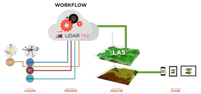
Phoenix LiDAR Unveils LiDAR Mill, the First Cloud-Based Post-Processing Platform
Cloud-based LiDAR platform automates trajectory processing, making the technology more affordable and accessible LOS ANGELES, CA (PRWEB) OCTOBER 26, 2017 – Addressing a major opportunity in the LiDAR industry, Phoenix LiDAR Systems

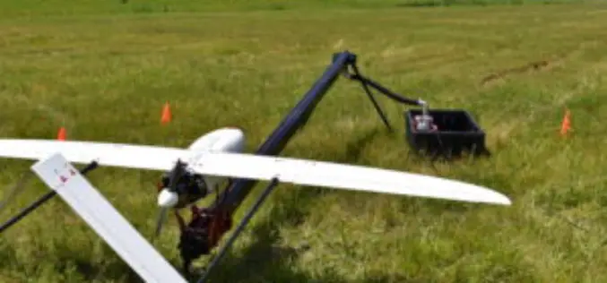
Velodyne LiDAR Partners with YellowScan for Integrated LiDAR for UAVs
YellowScan to leverage Velodyne’s lightweight VLP-16 Puck LiDAR sensors for its advanced aerial Surveyor LiDAR system October 26, 2017 – SAN JOSE, Calif.–(BUSINESS WIRE)–Velodyne LiDAR Inc., the world leader in 3D
IDS GeoRadar Unveils Ground Penetrating Radar to Improve Safety Before Cutting or Drilling into Concrete Structures
C-thrue is an all-in-one, robust solution to see through concrete structures and reveal true data October 24, 2017 – Pisa, Italy: IDS GeoRadar, a leading provider of multi-frequency, multi-channel Ground Penetrating

Kongsberg Geospatial Collaborating with Wind River for Safety-Critical Geospatial Applications
October 24, 2017 – Ottawa, CA: Kongsberg Geospatial, an Ottawa-based developer of geospatial software technology, announced today that they are collaborating with Wind River® to validate their safety-critical geospatial components for
4DMapper Incorporates Global Mapper SDK Enabling Cloud Based Geospatial Analytics
Hallowell, Maine – October 23, 2017 – Blue Marble Geographics (bluemarblegeo.com) is pleased to announce that 4DMapper (4dmapper.com), a geospatial technology company based in Australia, has chosen the Global Mapper Software
