
Business

NTT DATA and MapmyIndia to Develop First 3D Map Datasets for India
Tokyo, Japan, and New Delhi, India, May 21, 2018 – MapmyIndia is happy to announce its partnership with NTT DATA Corporation (TOKYO: 9613) a global IT solutions provider, to develop India’s first large-scale
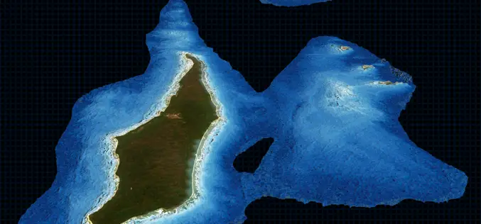
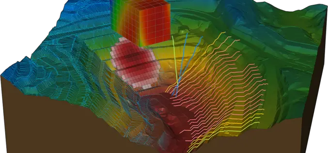
TCarta Delivers Satellite Derived Bathymetry Data to Total for Hydrocarbon Exploration Project
BRISTOL, United Kingdom, 16 May 2018 – TCarta, a global provider of marine geospatial products, has delivered satellite derived bathymetry (SDB) to Total SA, one of the world’s largest oil and gas producers.
Hexagon Acquires NEXTSENSE GmbH, A Leader in Industrial Measurement and Inspection Solutions
May 15, 2018 – Hexagon AB, a leading global provider of information technology solutions, announced today the acquisition of NEXTSENSE, a leading innovator in non-contact profile measurement and surface inspection.
OGC Seeks Public Comment on New Earth Observation Exploitation Platform Domain Working Group
New OGC Working Group has the goal of defining a standards-based framework for cloud-based access to and analysis of EO data. May 9, 2018 – The Open Geospatial Consortium (OGC) seeks
Trimble Business Center Software Adds New Vertical Solutions Support and Streamlines Field-to-Office Productivity
Enhancements for CAD, GIS, Infrastructure and Tunneling Applications SUNNYVALE, Calif., May 9, 2018—Trimble (NASDAQ: TRMB) announced today version 4.1 of Trimble® Business Center office software that enables surveyors and geospatial
Esri Announces Online Data Portal for Africa
One-Stop Shop Provides Location Data and Smart Mapping for a Sustainable, Progressive Africa May 8, 2018 – Redlands, California – Esri, the global leader in spatial analytics, today announced that it has
OGC Seeks Public Comment on New Interoperable Simulation and Gaming Domain Working Group
New OGC Working Group has the goal of evaluating how standards will enable the modeling, simulation, and gaming communities to mutually benefit from ongoing technological developments. May 7, 2018 – The
Maptitude Mapping Software Team Provides Corporate Sponsorship for NEGIS Spring Conference
NEWTON MA (USA) – The Northeast Geographic Information Society (NEGIS) Spring Conference was held on April 26, 2018 in Boston, Massachusetts. NEGIS is a charitable organization whose purpose is to
Bentley Systems Acquires Plaxis, and Complementary SoilVision, to Integrate Geotechnical Engineering within Digital Workflows for Infrastructure Projects
Comprehensive modeling environment now spans geo-structural and geo-environmental collaboration EXTON, Pa. – April 26, 2018 – Bentley Systems, Incorporated, a leading global provider of comprehensive software solutions for advancing infrastructure, today announced the acquisition
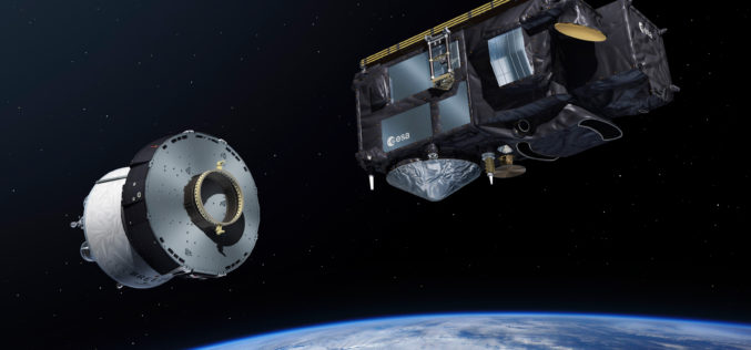
Sentinel-3B, 7th Satellite of the Copernicus Programme Launched Successfully
On 25 April 2018 at 19:57 CEST, the Earth observation satellite Sentinel-3B lifted off on a Rockot launcher from the Russian cosmodrome in Plesetsk With Sentinel-3B, the seventh satellite of
