
Business
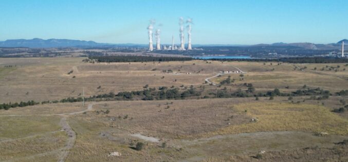
Carbonix, Woolpert Employ Cutting-Edge Drone to Collect Geospatial Data for Coal Mine Rehabilitation
Leading Australian drone manufacturer and solutions provider Carbonix is collaborating with global aerial survey specialist Woolpert to assist with the rehabilitation of one of New South Wales’ oldest open cut

GEOSAT Announces New Constellation, Reinforcing Its Global Position As A European Operator Of Very High-Resolution Satellites
The Portuguese Earth Observation company, and one of the two European operators of very high-resolution satellites, is starting a new phase of growth for the organization, with the aim of

Thrilled to Announce We Partnered with DroneX Tradeshow & Conference
We are thrilled to announce we are partnered with DroneX Tradeshow & Conference this year! Make sure to mark your calendars on the 26th & 27th of September and get
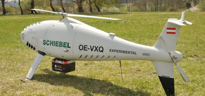
Successful Integration of the RIEGL VQ-840-G Topo-Bathymetric Laser Scanner into the Schiebel CAMCOPTER® S-100 UAS
RIEGL Laser Measurement Systems GmbH and SCHIEBEL have successfully completed the integration of a high-end laser scanning system, the RIEGL VQ-840-G topo-bathymetric LiDAR sensor, on the Schiebel CAMCOPTER® S-100 Unmanned
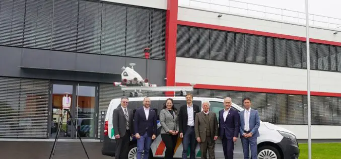
RIEGL LiDAR Technology for the Digital Twin Lab of JOANNEUM RESEARCH
In 2021, RIEGL was awarded the contract for the delivery of three laser scanning systems for the Digital Twin Lab of JOANNEUM RESEARCH. Now, post-COVID, the both teams could finally

PlanetObserver Releases an all-new 10m Global Imagery Basemap
PlanetObserver is excited to announce the release of PlanetSAT Global 2023, a basemap that provides ready-to-perform, cloudless, and homogeneous imagery. PlanetSAT Global now has a refined 10m zoom level PlanetObserver
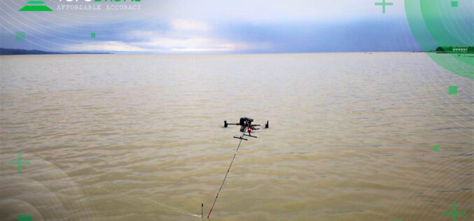
TOPODRONE – RASA Surveying Partnership Augments Coastal Mapping, Serves Resilient Communities
TOPODRONE, a Swiss based designer and manufacturer of high-precision surveying equipment, and RASA Surveying, an integrated surveying company, enter a technological partnership to advance airborne surveying approaches and accommodate coastal
RMSI Recognized as an Esri Cornerstone Partner for 20 Years of Commitment to Esri and ArcGIS Technology
RMSI was recently recognized as a Cornerstone Partner at the 2023 Esri Partner Conference (EPC) held in Palm Springs, California, March 4–6, 2023. This acknowledgment was presented to RMSI for

Geospatial Tech Firm Sets its Sights on Sustainable Data Solutions
One of the UK’s leading geospatial technology companies is scaling up its data-led asset management support for major utility and infrastructure organisations, helping to minimise their environmental impact. MGISS works with clients such as Northumbrian

Lemur Mobile GIS Solution from Locana Now an SAP® Endorsed App as Part of SAP’s Industry Cloud Portfolio
Lemur Adds Geospatial Capabilities to SAP Service and Asset Manager Mobile App Locana, an international leader in spatial technology, announced that SAP has premium certified Locana’s Lemur mobile GIS solution as an SAP Endorsed App. It is available on SAP® Store as part
