
Business

Leica Geosystems Introduces New Detection Solution for Utility Construction
Leica Geosystems introduces new detection solution for utility construction Heerbrugg, Switzerland 17 July 2018 – Leica Geosystems, part of Hexagon, industry leader of measurement technology, announced today the newest solution for

Chennai Metro Rail in Southern India Selects Trimble Rail Solutions for Remote Diagnostics, Condition Monitoring and Analytics
SUNNYVALE, Calif., July 17, 2018 — Trimble (NASDAQ: TRMB) announced today that Chennai Metro Rail Ltd. (CMRL), operated by the Tamil Nadu State Government and the Government of India, will
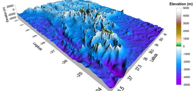
Golden Software Announces Educational Site License for Universities
GOLDEN, Colorado, 16 July 2018 – Golden Software, a developer of affordable software for scientific data visualization and analysis, has introduced a new unlimited licensing plan for universities and educational institutions.

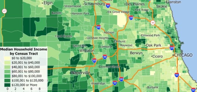
Free Point of Interest Data by Type for Use with Maptitude Mapping Software
NEWTON, MASSACHUSETTS (USA)- July 11, 2018- Free landmark point layers sorted by category are available for users of Maptitude 2018 and the United States, Australia, Canada, or United Kingdom Country Packages.
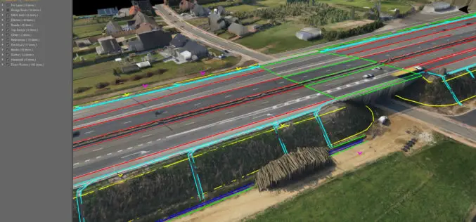
Virtual Surveyor Streamlines Workflow, Enhances User Experience with New Version of Drone Surveying Software
LEUVEN, Belgium, 10 July 2018 – The Virtual Surveyor drone surveying software now offers a faster, more efficient workflow and better overall user experience in a more stable platform. These
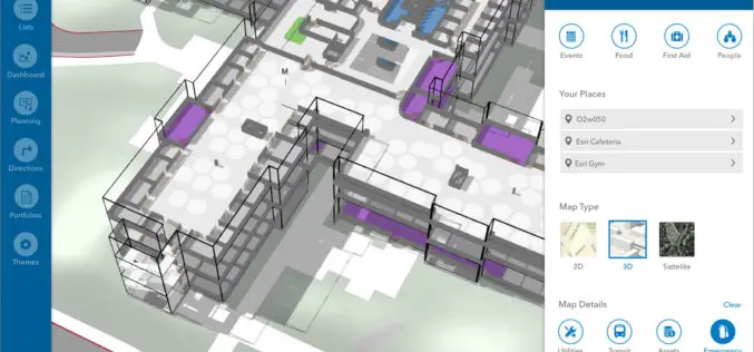
Esri Announces New Indoor Mapping Product
Redlands, California, June 9, 2018 – Esri , the global leader in location intelligence, today announced it will release ArcGIS Indoors, which will enable interactive indoor mapping of corporate facilities, retail and commercial

Novara GeoSolutions Unveils New Geospatial Product in Oil & Gas Industry
Norwell, MA – July 2, 2018 – Novara GeoSolutions (Novara) (www.novarageo.com), the industry’s leader in geospatial software and services for pipeline assets, announces the launch of a new product that is intuitive and

TomTom Mapping Data to Power End-To-End Analytics Platform
Alteryx customers can now accelerate development of data science and analytic models with TomTom’s Map Data and APIs Amsterdam, the Netherlands, June 29 2018 – TomTom (TOM2) today announced that
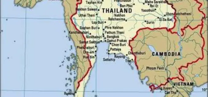
Airbus to Provide an End-to-end Geo-Information System to Thailand
Earth observation satellites, capacity building, integrated geo-information platform to support the Kingdom of Thailand’s key development priorities The Geo-Informatics and Space Technology Development Agency of Thailand (GISTDA) has selected Airbus
New 2018 Country Packages for the USA, Australia, Brazil, Canada, Mexico, New Zealand, and UK & Ireland
NEWTON, MASSACHUSETTS (USA) – Caliper is excited to announce the release of new 2018 Country Packages for its Maptitude mapping software. Maptitude Country Packages bring the power and flexibility of our
