
Business
UrtheCast and Land O’Lakes, Inc. Announce Term Sheet for Purchase of Geosys
Acquisition will create a unique, fully integrated imagery data and geoanalytics solution in the agribusiness industry. VANCOUVER, August 14, 2018 — UrtheCast Corp. (TSX: UR) (“UrtheCast”) and Land O’Lakes, Inc.

Airbus Defence and Space selected by Telesat to further develop the design of its LEO satellite constellation
Toulouse, 3 August 2018 – Airbus Defence and Space has been selected by Telesat as a major industrial partner to support their System Design and Risk Management phase for Telesat’s LEO

Space Flight Laboratory to Highlight Autonomous Formation Flight Technology at Small Satellite Conference
TORONTO, Ontario, Canada, 2 August 2018 – Space Flight Laboratory (SFL), which is celebrating its 20th year of developing complete microspace missions, will highlight autonomous formation flight technologies for micro-

3D Laser Mapping & GeoSLAM Global Merger Announcement
3D Laser Mapping Ltd and GeoSLAM Ltd Merge, Creating a Global Market Leader in Mapping and Monitoring Nottingham, England, 1st August 2018 – Leading UK laser scanning and monitoring companies’ 3D
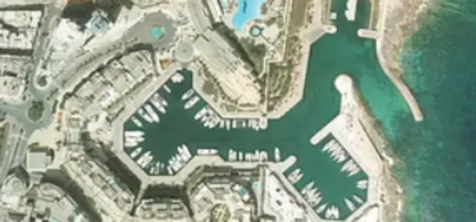
LiDAR Aerial Photo Bluesky Aerial Survey Helps Malta Develop GeoSpatial Infrastructure
July 31, 2018 – Aerial mapping company Bluesky has captured aerial photography and 3D map coverage of Malta. Working alongside tender lead IIC Technologies and Ordnance Survey, Bluesky captured ultra-high resolution

A City in 2 Billion Points
July 31, 2018 – In 2014 the Institut Cartogràfic i Geològic de Catalunya (ICGC) scanned an area of 1900×1200 meters around the La Sagrada Família in the city of Barcelona using
Woolpert Achieves the Location-Based Services Partner Specialization in the Google Cloud Partner Specialization Program
This honor reflects the firm’s technical proficiency and proven success in Location-Based Services using Google Cloud Platform technology. DAYTON, Ohio (July 30, 2018) — Woolpert has achieved the Location-Based Services Partner Specialization
Eagleview® Sets New Standard for Aerial Image Capture With Acquisition of Spookfish
Leading provider of aerial imagery and data analytics commits to next-generation aerial image capture technology, advancing industry standards for both image resolution and capture efficiency. Bothell, WA (July 25, 2018) – Eagle
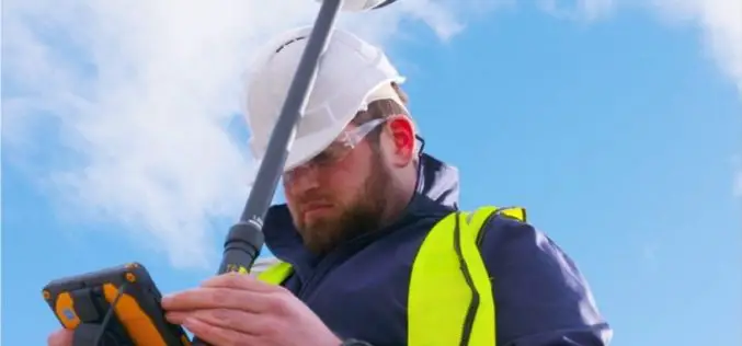
Leica Geosystems, GeoPal Partner to Add High Accuracy to Mobile Operations, Drive Efficiency, Productivity…
Leica Geosystems, GeoPal partner to add high accuracy to mobile operations, drive efficiency, productivity, ensure safety benefits for utility asset collection (Heerbrugg, Switzerland, 26 July 2018) – Leica Geosystems, part
Geospatial Intelligence Startup Ursa Announces $5.7 Million in New Funding
Plans to expand global monitoring capabilities for high impact business applications ITHACA, NY – July 19, 2018 – Ursa Space Systems, a provider of geospatial intelligence solutions, recently announced $5.7 million in
