
Business

Hexagon Digitalizes and Democratizes the Census Process with Complete Census Management Solution
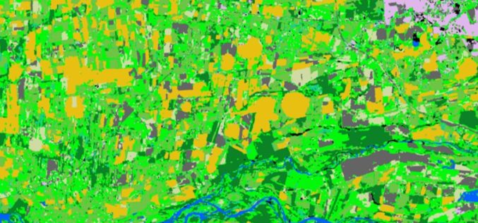
NORCROSS, GA., October 10, 2018 – Hexagon’s Geospatial division is pleased to announce the launch of its total Population and Housing Census (PHC) management and workflow solution, HxGN Smart Census. This
Spottitt Launches Cloud-Based Geospatial Data Analysis on DNV GL’s Veracity Platform
Online Imagery Portal with Analytics HARWELL, United Kingdom, 9 October 2018 – Spottitt Ltd. has launched a cloud-based workspace that puts massive satellite imagery sources and advanced analysis capabilities at
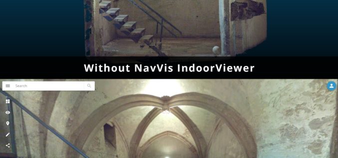
NavVis IndoorViewer Now Converts Static Scans Into Immersive 360° Imagery
New software feature brings full functionality of IndoorViewer to structured E57 point cloud files MUNICH, Germany, October 8th, 2018 – NavVis, a leading provider of indoor spatial intelligence technology, can
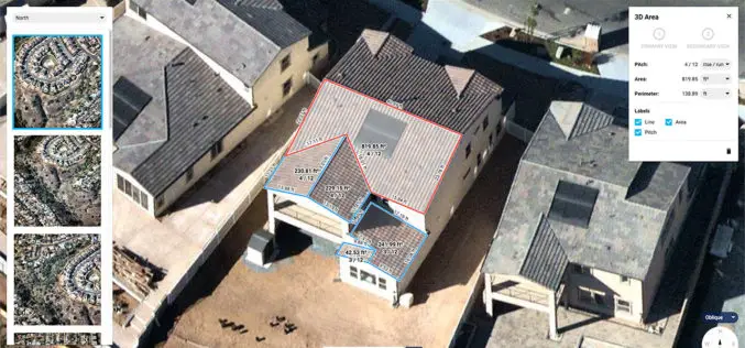
Introducing Roof Pitch and Area Tools for Solar and Roofing
New MapBrowser provides roof-pitch, height, width and area tools to help companies measure rooftops and structures without onsite inspections; gives small businesses the same advantages as large companies to improve
Extensis and LizardTech Unite as One Company
Combined company helps organizations increase the ROI and value of their digital assets, fonts, and large imagery Portland, Ore.―October 2, 2018 – Extensis® and LizardTech today announced they are uniting
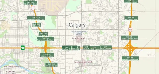
Free Highway Exits & Interchanges Data for Use with Maptitude 2018
Newton, Massachusetts (USA) – Caliper is excited to announce the release of new highway exit data for the United States and Canada. Users of Maptitude 2018 with the Canada or United States
PCI Geomatics Releases Geomatica and GXL 2018
MARKHAM, Ontario, Canada, October 1, 2018 — PCI Geomatics announced today the release of Geomatica 2018, the company’s flagship software for complete and integrated desktop and enterprise geoimage processing. Geomatica
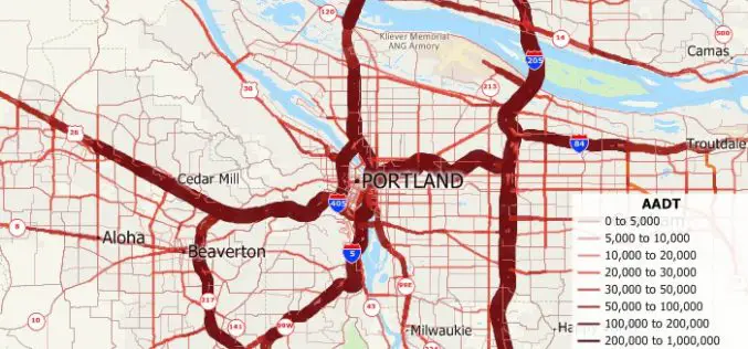
Free U.S. Traffic Count Data for Use with Maptitude 2018 Mapping Software
Newton, Massachusetts (USA) – Caliper is excited to announce the release of free USA traffic count data for Maptitude 2018 users. This latest map layer includes fields with total Annual Average Daily Traffic

Pix4D Accelerates Growth with A New Office in Madrid
A centre of innovation in the heart of Spain Lausanne, Switzerland: On November 1st 2018, Pix4D opens a new R&D office in Madrid. It is the company’s fifth office after

Topcon Agriculture and Raven announce API Partnership
TURIN, Italy – September 6, 2018 – Topcon Agriculture and Raven Industries, both leaders in the precision agriculture market, announced today a licensing agreement for use of the Slingshot Application
