
GIS
NOAA’s Online Mapping Tool ERMA Opens up Data to the Public
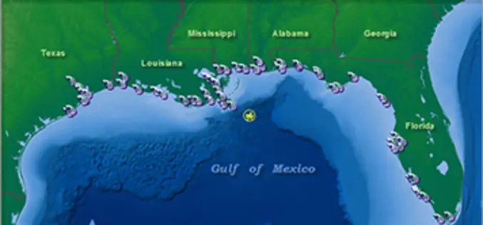
NOAA’s Environmental Response Management Application (ERMA) is a web-based mapping application that pulls in and displays both static and real-time data, such as ship locations, weather, and ocean currents. ERMA enables

Improve Underground Utilities Management and Public Safety by 3D GIS
Developed by Supergeo Technologies, SuperGIS 3D Earth Server is going to support underground utilities management. The breakthrough tech enables administrators to comprehend the distribution of underground utilities that cannot be
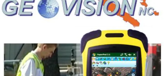
GEOVISION Utilizes SuperGIS for Maritime and Land GIS Planning
Supergeo Technologies Inc., the leading GIS software and solution provider, announces that GEOVISION, Nouvelle-Calédonie, selects cross-platform SuperGIS series products, SuperGIS Desktop, SuperSurv and SuperVeyor, to elevate its maritime and land

Learn Web GIS, Step by Step
Redlands, California—The growing popularity of web maps and apps calls for a workforce well versed in building them. That’s why Esri has published Getting to Know Web GIS, a new
Drought Monitoring and Visualization with Open Data
Drought is condition when a region notes a deficiency in its water supply whether surface or underground water. A drought can last for months or years, or may be declared after
PAOneStop Online Tool for Farmers to Map Farm
The Penn State Cooperative Extension Land Analysis Lab has developed PAOneStop, an online tool for farmers. PAOneStop provides online tools to help farmers meet regulatory requirements for Conservation and Nutrient Management

Vietnam and Japan Signed MoU to Cooperate in Geospatial Sector
The Vietnam Department of Survey and Mapping (VDSM) and the Geospatial Information Authority of Japan (GSI) exchanged a Memorandum of Understanding (MoU) on March 11 in Hanoi to commit to
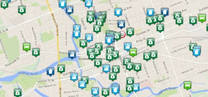
Crime Mapping Tool for Better Crime Monitoring
Bair Analytics Inc. will be providing online crime mapping service to the London Police Service and public. Each occurrence is represented by an icon that, when selected, will reveal information about each
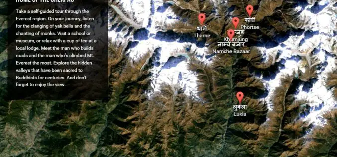
Climb the Mount Everest with Google Street View
Google has added the Khumbu region of Nepal, famously known as the Mount Everest region, to its Street View with extensive mapping and photographs. Google has now taken street view
Climate Change Vulnerability Index System
To handle climate changes and reduce the loss of lives and properties, Taiwan government establishes a SuperGIS-powered platform, to provide latest information to support decision making. To address climate changes

