
GIS

New National Geospatial Program Director Announced
The U.S. Geological Survey is pleased to announce the selection of Michael Tischler to the position of the Director, National Geospatial Program (NGP), starting Monday, April 6th. Mike brings a

Play Pac Man with Google Maps on Your Streets
Recently Google Maps has launched “Pac Man” in Google Maps. Team at Google Maps has coded a web application that lets users turn any city into classic arcade of game with hungry
Bhuvan Bhujal Portal – Ground Water Prospects Information System
The National Remote Sensing and Application Centre (NRSC), India has recently launched a web application “Bhujal Portal”. Bhujal is sponsored project by Department of Drinking Water and Sanitation, Ministry of Drinking
New Esri MOOC Tailored for Business Students
Redlands, California—Building on the success of its initial massive open online course (MOOC), Esri announces The Location Advantage, which is designed for recent graduates and current students majoring in business.

Smartone C from Smartplanes Reviewed By the Geo-Matching Community
The Geo-matching.com website features a selection of the most important geomatics equipment, including UAS for Mapping and 3D Modelling. At www.geo-matching.com, you can compare product specifications and read users’ reviews
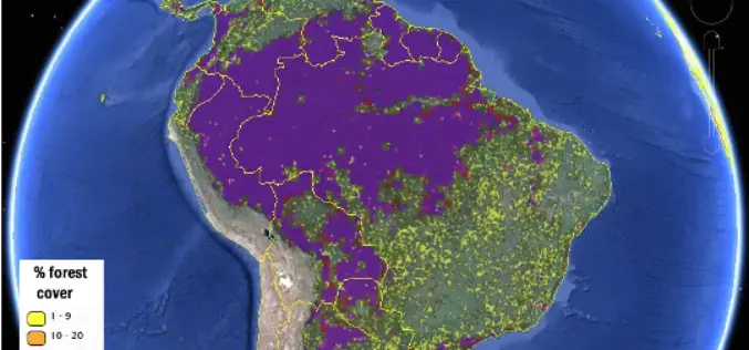
More Accurate View of Global Forest Map from IIASA
New global forest maps combine citizen science with multiple data sources, for an unprecedented level of accuracy about the location and extent of forestland worldwide. At International Institute of Applied
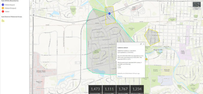
Esri Releases Nighttime Flow Analysis Solution to Identify Water Loss in Metered Service Areas
New Esri Solution Uses Location Analytics to Slash Discovery Time of Nonrevenue Water Loss at Utilities Redlands, California—Esri this month announced the release of its Nighttime Flow Analysis solution. This
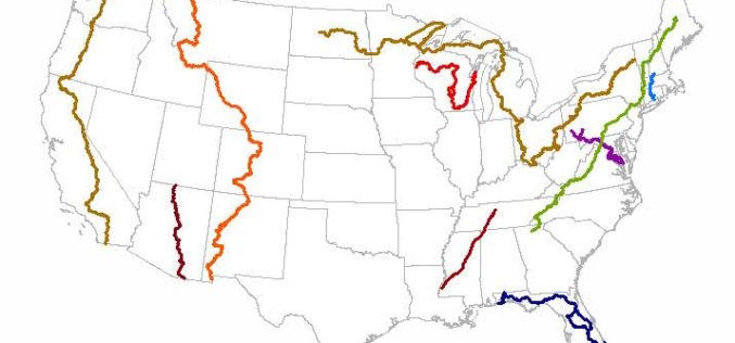
Newly Released US Topo Maps for California Now Feature Selected Trails
Newly released US Topo maps for California now feature selected trails and other substantial updates Several of the 2,798 new US Topo quadrangles for California now display public trails along
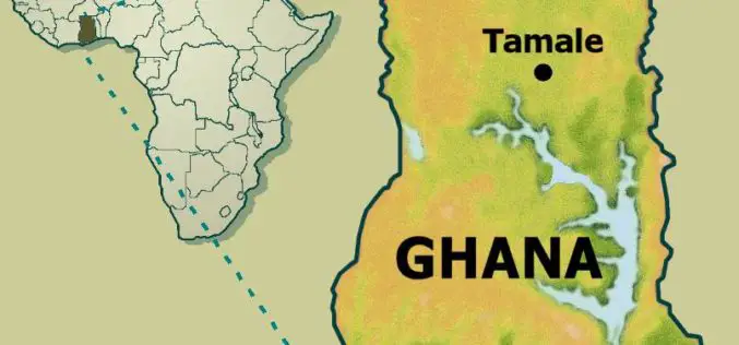
Institute of Local Government Studies (ILGS), Ghana Launches Centre for Geospatial Intelligence Services
The Institute of Local Government Studies, which aims at building capacity for local governance, has launched the Centre for Geospatial Intelligence Services (CGIS) and the Local Governance Observatory (LGO). Centre for

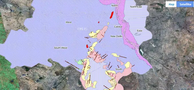
New Delhi to Go 3D Mapping for Smart City
According to recent news, New Delhi Municipal Council will soon start 3D mapping of city as a part of smart city project.Smart city optimally utilize information technology to habilitate the

