
GIS

Nominations Open for the Prestigious Carl Pulfrich Award 2015
Heerbrugg, Switzerland, 26 May 2015 – Hexagon Geosystems is pleased to continue the tradition of promoting outstanding scientific, application-oriented design and/or manufacturing activities in the field of photogrammetry, remote sensing
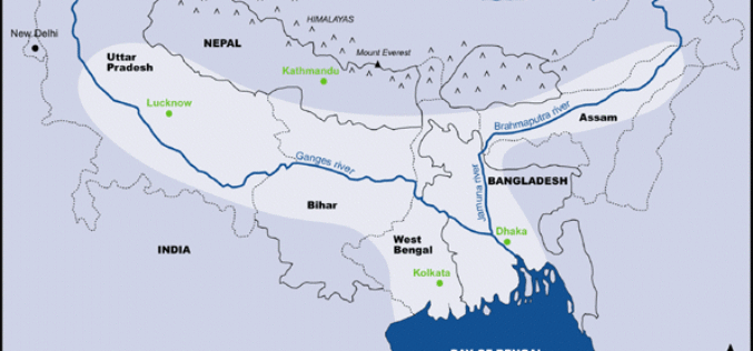
Ganga-Bramhaputra Basin Mapped In First of Its Kind Study
The Ganga-Bramhaputra Basin together store around 960 cubic km of water, researchers have claimed in a first of its kind study after mapping the rivers, and said it will help
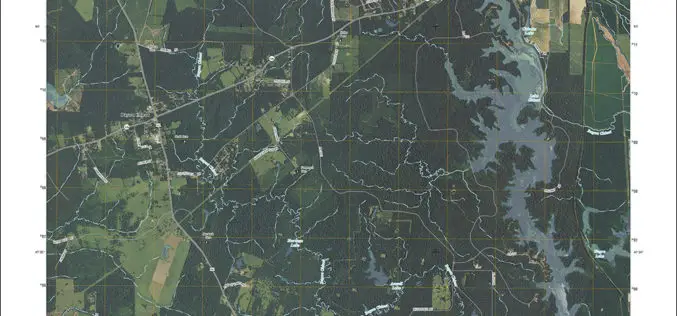
Louisiana Quads Add Trails and Survey Data
Newly released US Topo maps for Louisiana feature select trails and other updates Several of the 812 new US Topo quadrangles for Louisiana now display public trails along with improved

South Africa Introduce New Regulations for UAS
South Africa has recently announces the introduction of new regulation for remotely piloted aircraft systems (UAS). Traditionally, remotely piloted aircraft systems were used primarily in military operations; while their useful
CBC Iberia, Spain Adopts SuperSurv for Android to Elevate Data Collection Efficiency
Supergeo Technologies, the leading provider of complete GIS software and solutions,announces that CBC Iberia S.A., Spain adopts SuperSurv for Android in enhancing outdoor data collection for biotechnologies and agriculture. CBC

KU Awarded New FAA Center of Excellence Designation
The University of Kansas is among three universities across the states that are members of the new Federal Aviation Administration Center of Excellence for Unmanned Aircraft Systems, or UAS, which
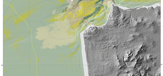
New Maps Reveal Seafloor off San Francisco Area
SANTA CRUZ, Calif. — Three new sets of maps detail the offshore bathymetry, habitats, geology and submarine environment of the seafloor off the coast of San Francisco, Drakes Bay, and

EMMa an Online Disease Mapping Tool
European Centre for Disease Prevention and Control (ECDC) has launched a web-based geographic information system (GIS) tool for mapping communicable disease and that supports production of maps. The tool, called ECDC
Delhi Govt to Use Remote Sensing Technology to Check Illegal Construction
New Delhi – May 20, 2015: Delhi Government on Wednesday said it will use remote sensing satellite technology to check and map unauthorised constructions and encroachments in the city and

RIEGL LIDAR 2015 User Conference: Thrilling Success in Hong Kong and Guangzhou!
RIEGL closed its ambitious LIDAR 2015 “One Conference, Two Exciting Locations” in Hong Kong and Guangzhou with a record number of more than 550 total attendees from over 40 countries

