
GIS
176 Flood Forecasting Stations Established Across India
As many as 176 flood forecasting stations have been set up across the country where predictions are made during every monsoon whenever the water level exceeds limits, Water Resources Minister

ISRO Teams Up With Urban Development Ministry, To Map 4,041 Towns
The Indian Space Research Organisation (ISRO) has tied up with the Union Urban Development Ministry for mapping over 500 towns and cities, to make a base plan for better planning
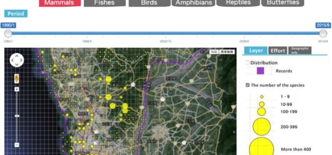
Conserve Biodiversity with GIS – Kaohsiung City Biodiversity Database
As environment becomes the top issue in every country, governments and scientists are eager to find the balance between development and environment protection. GIS as the key solution, offers various
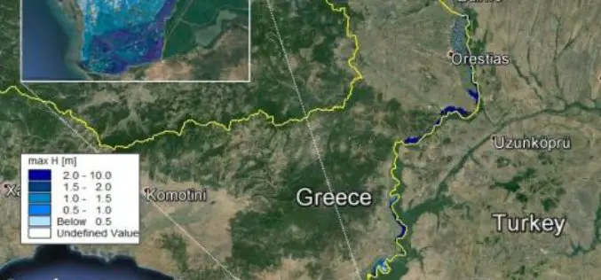
Conducting Flood Hazard and Risk Mapping For the Complex Evros River Basin
Z&A P. Antonaropoulos & Associates S.A. designed flood hazard and flood risk maps for the Greek part of the Evros River Basin after completing our MIKE FLOOD training course. The

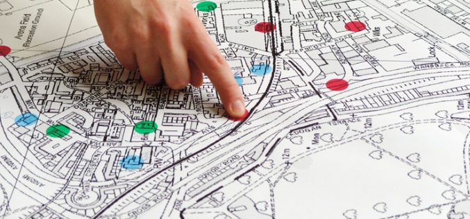
Portland State University Students Maps the Crime
A group of students (Bonn) in Portland State University’s Criminology & Criminal Justice program has did crime mapping of Portland city. Students have spent years poring over and analysis of nearly 25

FUTA Students Launch the Nigeria Open Data Access (NODA) Portal
Three students from the Federal University of Technology Akure (FUTA) have launched the Nigeria Open Data Access (NODA) portal. The Nigerian open data access is one of the few open data

Earthserver Project Goes Into the Second Round
The EarthServer initiative is establishing Agile Analytics on Petabyte data cubes as a commodity Pushing the boundaries of Big Earth Data services, the intercontinental Earthserver initiative enables researchers to browse,
Battling Wildfires from Space: NASA Adds to Firefighters’ Toolkit
U.S. firefighters battling wildfires this year will get a clearer view of these threats with new NASA-funded satellite-based tools to better detect fires nationwide and predict their behavior. The new
Property Sale Linking with GIS Maps
According to recent news by DNA, Maharashtra government is planning to link property sale with GIS Maps to make the system of computing ready reckoner rates more scientific and rational.
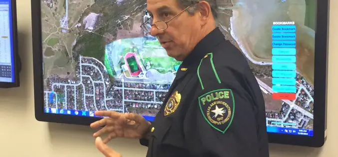
Mapping Application “SituMap”- Lets Emergency Responders See Scenes Virtually
CORPUS CHRISTI, Texas – A mapping application that lets first responders quickly and easily “see” an emergency situation with a digital command center is heading to the commercial market. The
