
GIS

Geotagging of Pipelines for Effective Water Supply Management
Hyderabad-India: According to recent news by The New Indian Express, the Hyderabad Metro Water Supply and Sewerage Board (HMWS&SB) has drawn plans to prepare a reliable and accurate GIS map
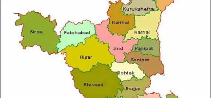
HARSAC Uses Drones to Create “Most Accurate Maps” of Gurugram for Land Records Management
New Delhi : Haryana State Remote Sensing Application Centre (HARSAC) and local administration made optimum use of the technology at their disposal as they used 24 satellites and drones to
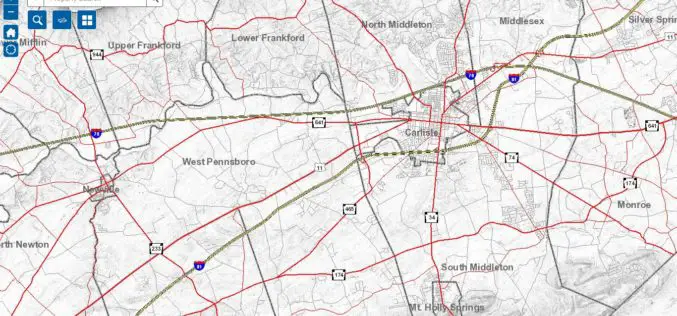
Cumberland County Launches New Property Mapper Application
Cumberland County, PA, January 3, 2017- At their public meeting today, the Cumberland County Board of Commissioners announced the release of a new online property mapper application now available to
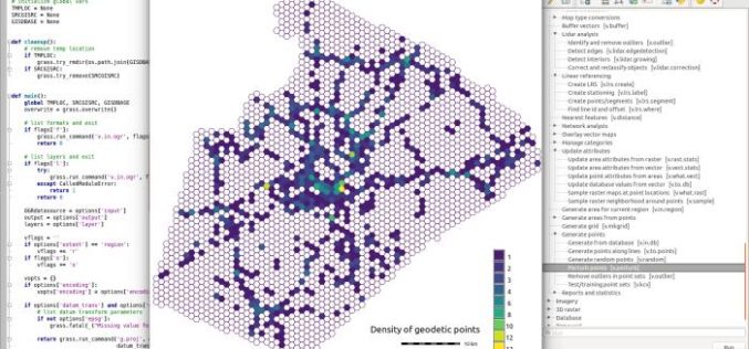
GRASS GIS 7.2.0 Released
After almost two years of development the new stable major release GRASS GIS 7.2.0 is available. It provides more than 1950 stability fixes and manual improvements compared to the former

Maharashtra Forest Dept Gets New GIS Based Command Centre to Monitor Forest Reserve
Maharashtra – According to recent news by The Hindustan Times, in a first for the country, the Maharashtra State Forest Department will use real-time satellite images of all forested areas
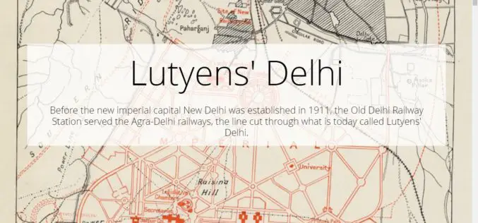
Lutyens’ Delhi
Contributed By:- Lutyens’ Delhi is an area in New Delhi, India, named after the British architect Edwin Lutyens (1869–1944), who was responsible for much of the architectural design and building
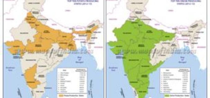
Agriculture Ministry Plans to Utilize Remote Sensing to Map Potato & Onion Cultivation Area
NEW DELHI: According to recent news by The Economic Times, the agriculture ministry is planning to use remote sensing technology to map the area under potato and onion cultivation for
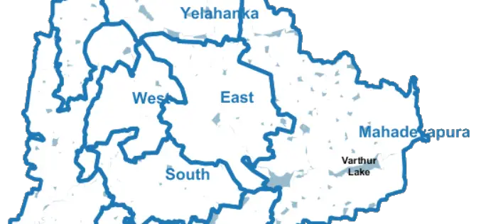
Bengaluru City to Have Geospatial Enabled Property Tax Information System
According to recent news by the Time of India, the online platform for property tax management has been set up by Bruhat Bengaluru Mahanagara Palike (BBMP) in association with the Indian
Esri ArcGIS 10.5 Release Transforms Spatial Analytics
Esri has released Esri ArcGIS 10.5 on December 19, the next-generation analytics technology includes the latest release of Esri’s enterprise GIS and unlocks the full potential of your data. Esri

Iran Urges Russia to Start Building Remote Sensing Satellite
The Iranian minister for Communication and Information Technology, Mahmoud Vaezi, urged Russia to start work on constructing the remote sensing satellite both countries agreed upon earlier this year. Speaking in
