
GIS
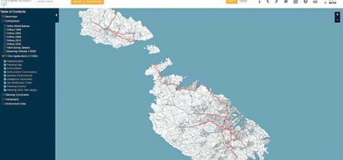
Planning Authority of Malta Launch New Online Mapping System
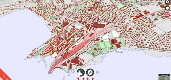
According to recent news by the Times of Malta, the Planning Authority has launched an online geographic information system (GIS), that would allow the public to access data in a faster
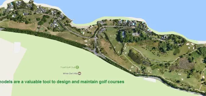
Three Reasons Golf Courses Are the Next Drone Mapping Territory
The emerald golfing greens have seen better days. According to the US National Golf Foundation, the number of players has almost steadily declined from over 30 million in 2005 (pre-recession),

ISRO Successfully Launched Cartosat-2 Series Satellite Along with 103 Co-passenger Satellites
Sriharikota, India – In its thirty-ninth flight (PSLV-C37), ISRO’s Polar Satellite Launch Vehicle successfully launched the 714 kg Cartosat-2 Series Satellite along with 103 co-passenger satellites today morning (February 15,

BRICS Nations to Share Data from Remote Sensing Satellites
IANS – Bengaluru: The five-nation group of BRICS will share spatial data on natural resources from their remote-sensing satellites for utilizing space assets optimally, said a top Indian space official on
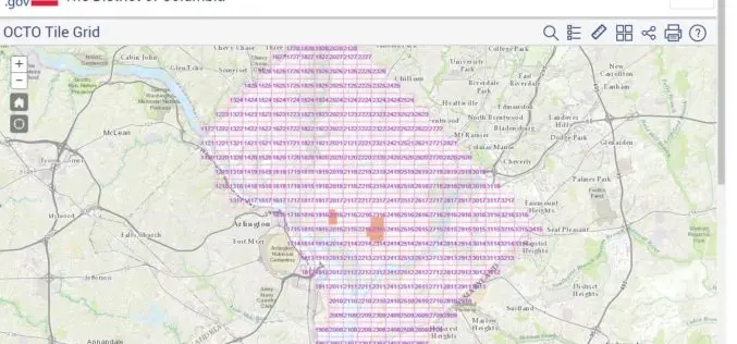
Classified LiDAR Point Cloud of Columbia Available on Amazon S3
According to recent updates on Amazon AWS, LiDAR point cloud data for Washington, DC is available for anyone to use on Amazon S3. The dataset, managed by the Office of the Chief

NATMO Prepared Braille Atlas for Visually Impaired
New Delhi, India – According to recent news reported by the Business Standard, the Union Minister for Science & Technology and Earth Sciences Dr. Harsh Vardhan released the Special Edition of

National Institute of Oceanography to Map the Coastline of Andhra Pradesh
Visakhapatnam – According to recent news reported by The Hindu, the National Institute of Oceanography (NIO), research laboratories under the Council of Scientific and Industrial Research, will undertake a project
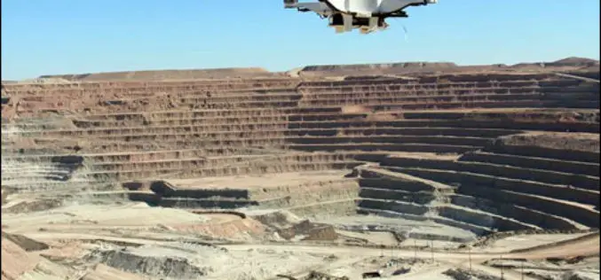
Drones Soon to Check Illegal Mining
Chennai – According to recent news reported by The New India Express, Madras High Court has directed the State government and the Union Ministry of Mines to take a decision
Cesium’s 3D Tiles Selected for Swiss Geospatial Portal
Swiss government agency adopts Cesium & its 3D Tiles format to offer extensive national geodata collection via BETA Version of an online interactive portal. PRWeb – Switzerland’s national mapping agency,
Download for Free – Esri Release ArcGIS Earth 1.4
Recently Esri 3D team has announced the release of ArcGIS Earth 1.4. ArcGIS Earth 1.4 introduces great new features that will enhance workflows for visualizing data, accessing portals, and sharing across
