
GIS
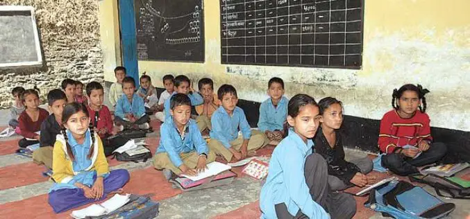
Uttar Pradesh: New Government Schools Only After GIS Mapping
Uttar Pradesh, India – According to recent news by The Hindustan Times, Uttar Pradesh will now get new government-run primary and upper primary schools only after completion of Geographic Information System
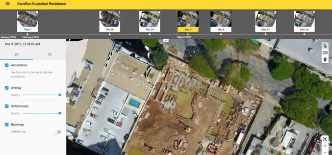
More efficient construction management with Pix4Dbim
More efficient construction management with Pix4Dbim The importance of easy data visualization for Jobsite documentation Project info Project Description A volcanic archipelago in the Central Pacific of only 11,000 square miles, Hawaii
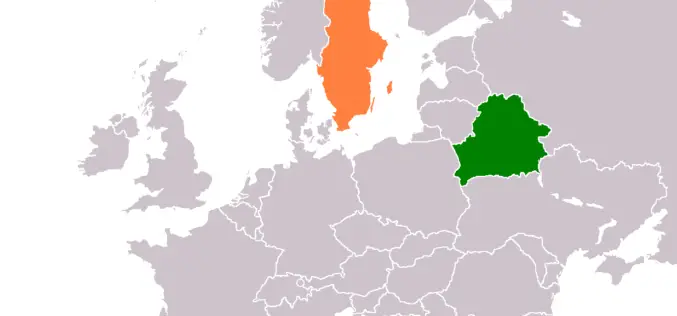
Belarus, Sweden to Share Experience in GIS Development
MINSK, 26 April (BelTA) – Belarus and Sweden will exchange experience in geographic information systems (GIS) development, BelTA learned from Belarus’ State Property Committee. A delegation of specialists of the
University of Guelph: Prof. John Lindsay Develops Whitebox Geospatial Analysis Tools for Processing Geospatial Data
Professor John Lindsay has developed a one-of-a-kind software package called Whitebox Geospatial Analysis Tools for processing geospatial data that he says has put the University of Guelph on the map

China Unveils Results of First National Geoinformation Survey
China boasts a total of 7.56 million square kilometers of vegetation cover, while buildings cover 153,000 square kilometers of land, the State Council Information Office unveiled at a news briefing
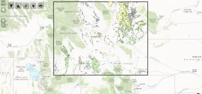
WSGS Completes First Update to Online Oil and Gas Map since its Launch in July
The Wyoming State Geological Survey (WSGS) has completed the first update to its online Oil and Gas Map of Wyoming, including revising the map’s data and improving its functionality. The
China Draws 3D Topographic Map of Antarctic Seabed
Chinese scientists have created a three-dimensional, digital topographic map of the Antarctic seabed using data collected during a recent expedition. The map was presented at a press briefing held Friday
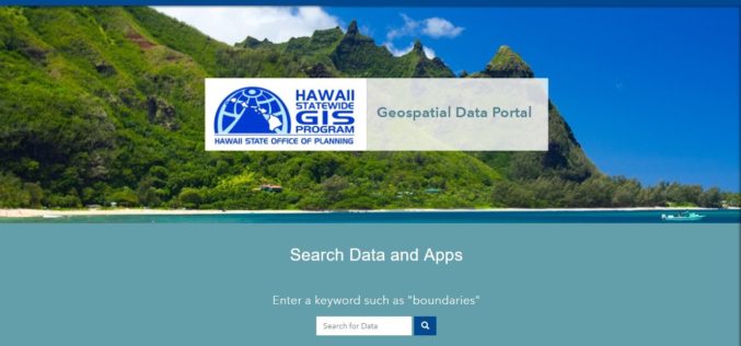
Hawaii Launches Geospatial Data Portal
According to recent news, the state Office of Planning’s Hawaii Statewide Geographic Information System (GIS) Program launched a new Geospatial Data Portal, which provides streamlined access to hundreds of data
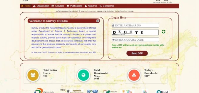
Survey of India Launches Web Portal to Download Maps
According to recent news reported by PTI, the government on Monday launched a website giving people the access to download 3,000 maps prepared by the Survey of India (SoI) but
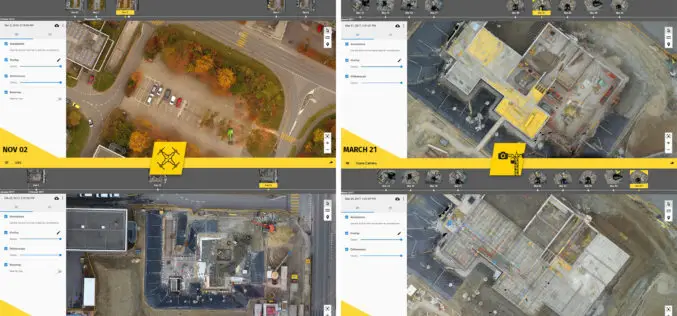
6 Major Construction Companies Adopt New Bim Monitoring Solution
Construction professionals understand that daily visualization of a job site helps minimize construction delays, prevent clashes between as-built and as design, eliminate the need for rework, facilitate stakeholder communication and

